VVestiges of New York49,000+ historical photos
MapBrowseAboutGet the iPhone app (opens the App Store)
  1. Browse /
  2. Manhattan /
  3. This place

7th Avenue & 150th Street, Manhattan

6 historical photos taken here between 1936 and 1937, oldest first.

See this spot on the map

Photos

  • Manhattan: 7th Avenue - 150th Street, 1936

    Manhattan: 7th Avenue - 150th Street

    1936

  • Manhattan: 7th Avenue - 150th Street, 1936

    Manhattan: 7th Avenue - 150th Street

    1936

  • Manhattan: 7th Avenue - 150th Street, 1936

    Manhattan: 7th Avenue - 150th Street

    1936

  • Manhattan: 7th Avenue - 150th Street, 1937

    Manhattan: 7th Avenue - 150th Street

    1937

  • Manhattan: 7th Avenue - 150th Street, 1937

    Manhattan: 7th Avenue - 150th Street

    1937

  • Manhattan: 7th Avenue - 150th Street, 1937

    Manhattan: 7th Avenue - 150th Street

    1937

Stand where these photos were taken

The free OldNYC app for iPhone centers the map on you and shows the historical photos taken closest to where you are.
Download on the App Store (opens the App Store)
QR code that opens OldNYC on the App Store

Or scan with your iPhone

Nearby places

  • 7th Avenue & 151st Street, Manhattan (12 photos)
  • 7th Avenue & 152nd Street, Manhattan (5 photos)
  • Macombs Place & West 153rd Street, Manhattan (4 photos)
  • 152nd Street & Macombs Place, Manhattan (2 photos)
  • 7th Avenue & 147th Street, Manhattan (3 photos)
  • West 153rd Street & 7th Avenue, Manhattan (2 photos)
  • 8th Avenue & 154th Street, Manhattan (3 photos)
  • West 150th Street & Cromwell Avenue, Manhattan (5 photos)

Explore

  • Map
  • Browse by place
  • Browse by decade

Boroughs

  • Manhattan
  • Brooklyn
  • Queens
  • Bronx
  • Staten Island

About

  • About and contact
  • Privacy

Photos: The New York Public Library, Milstein Collection

OldNYC for iPhone

Find the historical photos taken closest to where you stand.

Download on the App Store (opens the App Store)QR code that opens OldNYC on the App Store
Manhattan: 7th Avenue - 150th Street, 1936

Photo 1 of 6 at 7th Avenue & 150th Street, Manhattan

Manhattan: 7th Avenue - 150th Street

1936

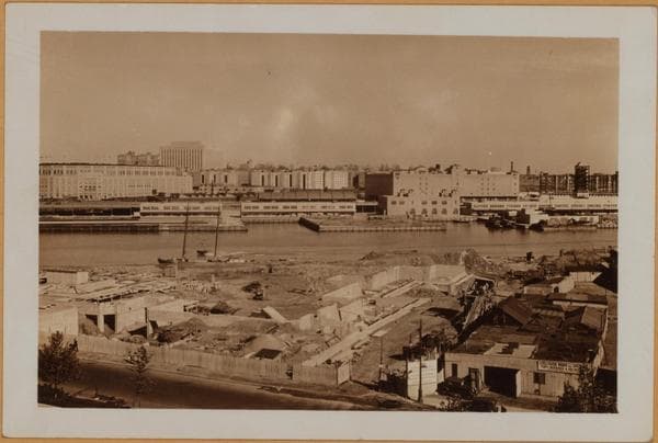
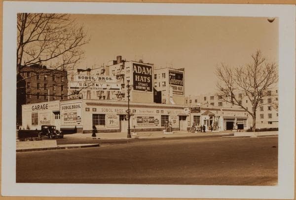
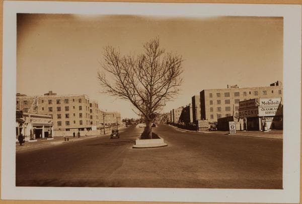
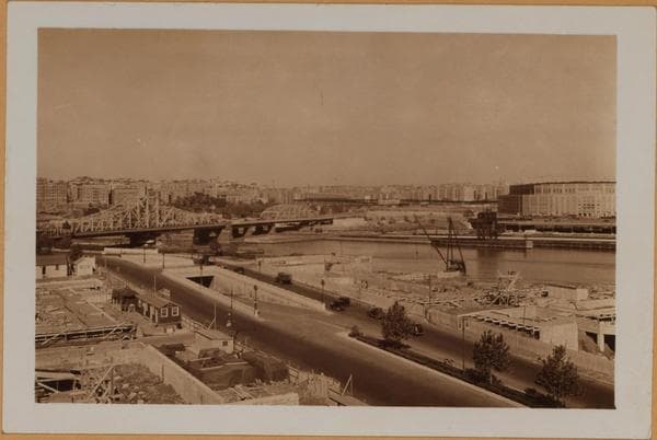
Seventh Ave., north from about West 150th Street, to the Central Bridge West 155th Street. A panoramic view of the new U.S. Government slum clearance and housing project in Harlem; a local subdivision of Manhattan and bordering onto the Harlem River. This scene consists of 3 views; each a continuation of the other, and showing mainly the development on the east side of Seventh Ave. View No. 1 being mainly the area comprising 152nd to 155th Streets; view No. 2, 151st to 152nd Street; and view No. 3, 151st to 150th Street. West 150th Street is the northern boundry of the Interborough Rapid Transit Car Yard. Across the Harlem River is shown the Borough of Bronx, with the Yankee Stadium south of the bridge. September 19, 1936. P. L. Sperr.

Photo from the New York Public Library - Milstein Collection
See this spot on the mapView on NYPL Digital Collections (opens in a new tab)

See this photo in high resolution

Zoom into the full-resolution scan in the OldNYC app for iPhone with OldNYC Supporter ($4.99). The free app also centers the map on you, so you can find the photos taken closest to where you stand.
Download on the App Store (opens the App Store)
QR code that opens OldNYC on the App Store

Or scan with your iPhone