VVestiges of New York49,000+ historical photos
MapBrowseAboutGet the iPhone app (opens the App Store)
  1. Browse /
  2. Queens /
  3. This place

Main Avenue & Vernon Boulevard, Queens

15 historical photos taken here between 1922 and 1940, oldest first.

See this spot on the map

Photos

  • Queens: Main Avenue - Park Row, 1922–1923

    Queens: Main Avenue - Park Row

    1922; 1923
  • Queens: Main Avenue - Park Row, 1922–1923

    Queens: Main Avenue - Park Row

    1922; 1923

  • Queens: Main Avenue - Park Row, 1922–1923

    Queens: Main Avenue - Park Row

    1922; 1923
  • Queens: Main Avenue - Park Row, 1922–1923

    Queens: Main Avenue - Park Row

    1922; 1923
  • Queens: Main Avenue - Vernon Boulevard, 1925

    Queens: Main Avenue - Vernon Boulevard

    1925

  • Queens: Main Avenue - Vernon Boulevard, 1925

    Queens: Main Avenue - Vernon Boulevard

    1925

  • Queens: Main Avenue - 8th Street, 1927

    Queens: Main Avenue - 8th Street

    1927

  • Queens: Main Avenue - Vernon Boulevard, 1927–1940

    Queens: Main Avenue - Vernon Boulevard

    1927; 1940
  • Queens: Main Avenue - Vernon Boulevard, 1927–1940

    Queens: Main Avenue - Vernon Boulevard

    1927; 1940

  • Queens: Main Avenue - Vernon Boulevard, 1931

    Queens: Main Avenue - Vernon Boulevard
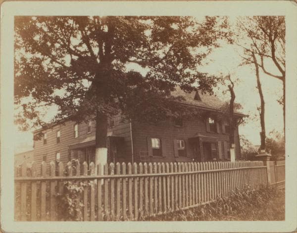
    1931

  • Queens: Main Avenue - Vernon Boulevard, 1922–1934

    Queens: Main Avenue - Vernon Boulevard

    1922; 1934

  • Queens: Main Avenue - Vernon Boulevard, 1922–1934

    Queens: Main Avenue - Vernon Boulevard

    1922; 1934
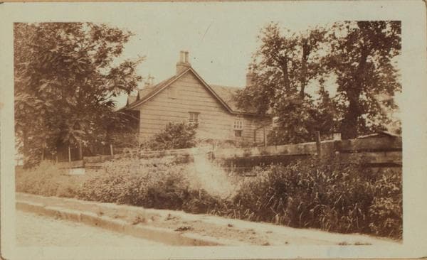
  • Queens: Main Avenue - Vernon Boulevard, 1922–1934

    Queens: Main Avenue - Vernon Boulevard

    1922; 1934

  • Queens: Main Avenue - Vernon Boulevard, 1922–1934

    Queens: Main Avenue - Vernon Boulevard

    1922; 1934

  • Queens: Welling Court - Main Avenue

    Queens: Welling Court - Main Avenue

    Unknown

Stand where these photos were taken

The free OldNYC app for iPhone centers the map on you and shows the historical photos taken closest to where you are.
Download on the App Store (opens the App Store)
QR code that opens OldNYC on the App Store

Or scan with your iPhone

Nearby places

  • Main Avenue & 30th Avenue, Queens (3 photos)
  • Astoria Boulevard & 8th Street, Queens (14 photos)
  • 30th Road & Vernon Boulevard, Queens (18 photos)
  • Welling Court & 30th Avenue, Queens (6 photos)
  • 27th Avenue & 8th Street, Queens (3 photos)
  • 27th Avenue & 9th Street, Queens (4 photos)
  • East River, Queens (4 photos)
  • 4th Street & 27th Avenue, Queens (20 photos)

Explore

  • Map
  • Browse by place
  • Browse by decade

Boroughs

  • Manhattan
  • Brooklyn
  • Queens
  • Bronx
  • Staten Island

About

  • About and contact
  • Privacy

Photos: The New York Public Library, Milstein Collection

OldNYC for iPhone

Find the historical photos taken closest to where you stand.

Download on the App Store (opens the App Store)QR code that opens OldNYC on the App Store
Queens: Main Avenue - Park Row, 1922–1923

Photo 2 of 15 at Main Avenue & Vernon Boulevard, Queens

Queens: Main Avenue - Park Row

1922; 1923

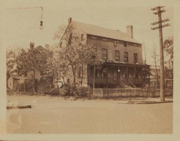
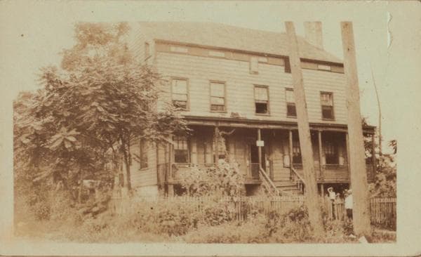
Main Avenue, foreground, at the S.W. corner of Welling Court, showing in a set of four views the S. A. Halsey house of 1873. It was demolished in 1928. Hendrick Suydam, a farmer of Bedford, bought the estate of William Lawrence, deceased, in 1794. Between 1825 and 1852 when S. A. Halsey purchased it, it was owned by one Whitfield. Before S. A. Halsey purchased it and made it his home, it had been a roadhouse at which he often stopped. This individual in 1849 purchased several farms at Astoria and laid out and opened Broadway, The Crescent, Emerald Street, Academy Street, Grand Street, First Ave., Second Ave., and Jamaica Ave. At about 1840 he purchased the Horn Hook Ferry running to 86th Street, New York City, which he operated for 30 years. Peter Fitzsimmons was the first operator of this line. This individual also conducted in 1782 a tavern at the house of the widow Betts at Halletts Cove. This was the house of Grant Thorburn in 1852. May 1923. Views 2,364: 1922. Eugene L. Ambruster Collection.

Photo from the New York Public Library - Milstein Collection

See this spot on the mapView on NYPL Digital Collections (opens in a new tab)

See this photo in high resolution

Zoom into the full-resolution scan in the OldNYC app for iPhone with OldNYC Supporter ($4.99). The free app also centers the map on you, so you can find the photos taken closest to where you stand.
Download on the App Store (opens the App Store)
QR code that opens OldNYC on the App Store

Or scan with your iPhone