VVestiges of New York49,000+ historical photos
MapBrowseAboutGet the iPhone app (opens the App Store)
  1. Browse /
  2. Manhattan /
  3. This place

East End Avenue & 79th Street, Manhattan

12 historical photos taken here between 1912 and 1939, oldest first.

See this spot on the map

Photos

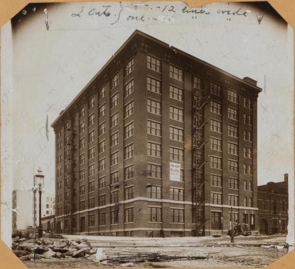
  • Manhattan: 79th Street (East) - East End Avenue, 1912

    Manhattan: 79th Street (East) - East End Avenue
    1912

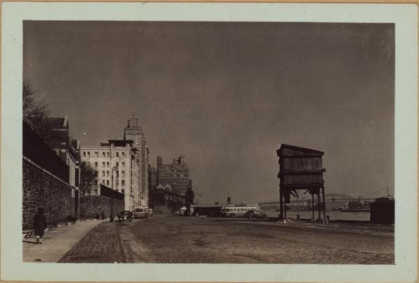
  • Manhattan: Marie Curie Avenue - 76th Street, 1926–1939

    Manhattan: Marie Curie Avenue - 76th Street

    1926; 1929; 1932; 1933; 1939
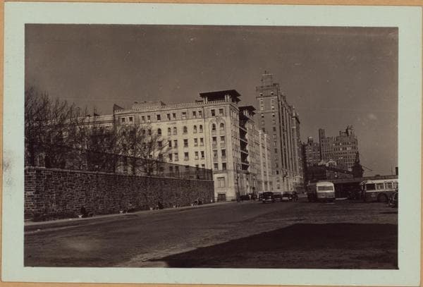
  • Manhattan: Marie Curie Avenue - 76th Street, 1926–1939

    Manhattan: Marie Curie Avenue - 76th Street

    1926; 1929; 1932; 1933; 1939
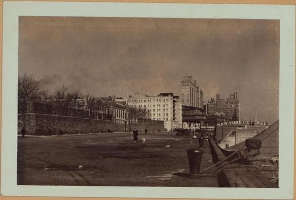
  • Manhattan: Marie Curie Avenue - 76th Street, 1926–1939

    Manhattan: Marie Curie Avenue - 76th Street

    1926; 1929; 1932; 1933; 1939
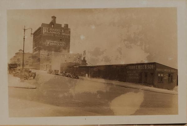
  • Manhattan: East End Avenue - 79th Street, 1927

    Manhattan: East End Avenue - 79th Street

    1927

  • Manhattan: East End Avenue - 79th Street, 1927

    Manhattan: East End Avenue - 79th Street

    1927

  • Manhattan: Marie Curie Avenue - 78th Street (East), 1927–1936

    Manhattan: Marie Curie Avenue - 78th Street (East)

    1927; 1930; 1936

  • East River - Manhattan shore - [Hagedorn Brothers Coal Company.], 1933–1939

    East River - Manhattan shore - [Hagedorn Brothers Coal Company.]

    1933; 1939
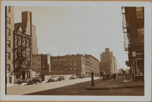
  • East River - Manhattan shore - [Hagedorn Brothers Coal Company.], 1933–1939

    East River - Manhattan shore - [Hagedorn Brothers Coal Company.]

    1933; 1939

  • East River - Manhattan shore - [Hagedorn Brothers Coal Company.], 1933–1939

    East River - Manhattan shore - [Hagedorn Brothers Coal Company.]

    1933; 1939

  • Manhattan: East End Avenue - 79th Street, 1935

    Manhattan: East End Avenue - 79th Street
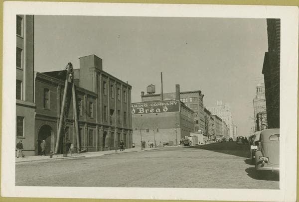
    1935

  • 79th Street (East) - East End Avenue, north side - looking north, 1939-02-12

    79th Street (East) - East End Avenue, north side - looking north

    1939-02-12

Stand where these photos were taken

The free OldNYC app for iPhone centers the map on you and shows the historical photos taken closest to where you are.
Download on the App Store (opens the App Store)
QR code that opens OldNYC on the App Store

Or scan with your iPhone

Nearby places

  • East End Avenue & 80th Street, Manhattan (7 photos)
  • East River Drive & East 78th Street, Manhattan (2 photos)
  • East River Drive & East 81st Street, Manhattan (5 photos)
  • East 76th Street & Cherokee Place, Manhattan (9 photos)
  • East End Avenue & 81st Street, Manhattan (5 photos)
  • 76th Street & Avenue A, Manhattan (13 photos)
  • East 83rd Street & East End Avenue, Manhattan (5 photos)
  • East River Drive & East 73rd Street, Manhattan (2 photos)

Explore

  • Map
  • Browse by place
  • Browse by decade

Boroughs

  • Manhattan
  • Brooklyn
  • Queens
  • Bronx
  • Staten Island

About

  • About and contact
  • Privacy

Photos: The New York Public Library, Milstein Collection

OldNYC for iPhone

Find the historical photos taken closest to where you stand.

Download on the App Store (opens the App Store)QR code that opens OldNYC on the App Store
Manhattan: Marie Curie Avenue - 76th Street, 1926–1939

Photo 2 of 12 at East End Avenue & 79th Street, Manhattan

Manhattan: Marie Curie Avenue - 76th Street

1926; 1929; 1932; 1933; 1939

Marie Curie Avenue, north from E. 76th Street, showing this marginal thoroughfare skirting the East River. In the near future, this, in its entirety will become a portion of the new East River Drive. Open area at the left, between 76th and 78th Streets is John Jay Park. The white structure beyond same is the Junior League's Residential Club. The prominent structure is an apartment house occupying the narrow block between this thoroughfare and East End Avenue from 78th to 79th Streets. In the background are buildings forming Gracie Square, another East Side residential zone. Note in the last photo the distant outlines of the Triboro and the Hell Gate (N.Y.C.R.R.) Bridges. February 12, 1939 Views 1,2 and 3 P. L. Sperr View 1 - Neg. # 2026 View 2 - Neg. # 2025 View 3 - Neg. # 2027

Photo from the New York Public Library - Milstein Collection

See this spot on the mapView on NYPL Digital Collections (opens in a new tab)

See this photo in high resolution

Zoom into the full-resolution scan in the OldNYC app for iPhone with OldNYC Supporter ($4.99). The free app also centers the map on you, so you can find the photos taken closest to where you stand.
Download on the App Store (opens the App Store)
QR code that opens OldNYC on the App Store

Or scan with your iPhone