VVestiges of New York49,000+ historical photos
MapBrowseAbout
  1. Browse /
  2. 1930s /
  3. This photo
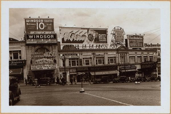
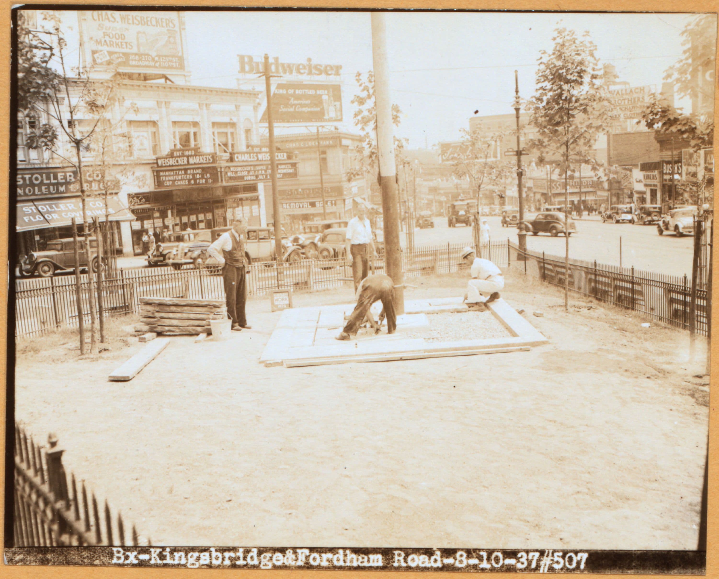
Bronx: Fordham Road (East) - Kingsbridge Road (East)

1937

Bronx: Fordham Road (East) - Kingsbridge Road (East)

E. Fordham Road (right), at E. Kingsbridge Road (left), showing the small public place, known as John E. Bryan Park, being improved by the Works Progress Administration. The view is eastward. August 10, 1937 W.P.A. Photo Five Boroughs Project

Photo from the New York Public Library - Milstein Collection
View this location on the map →View on NYPL Digital Collections (opens in a new tab) →

More photos from this spot

  • Bronx: Kingsbridge Road (Ea - Fordham Road (East)

    1870

  • Bronx: Bainbridge Avenue - Fordham Road (East)

    1923

  • Bronx: Bainbridge Avenue - Fordham Road (East)

    1923

  • Bronx: Bainbridge Avenue - Fordham Road (East)

    1936

  • Bronx: Fordham Road (East) - Kingsbridge Road (East)

    1938

  • Bronx: Bainbridge Avenue - Fordham Road (East)

    1923

  • Bronx: Bainbridge Avenue - Fordham Road (East)

    1936

  • Bronx: Bainbridge Avenue - Fordham Road (East)

    1937

  • Bronx: Bainbridge Avenue - Fordham Road (East)

    1936

  • Bronx: Bainbridge Avenue - Fordham Road (East)

    1936

About and contactPrivacyPhotos: The New York Public Library, Milstein Collection