VVestiges of New York49,000+ historical photos
MapBrowseAbout
  1. Browse /
  2. 1930s /
  3. This photo
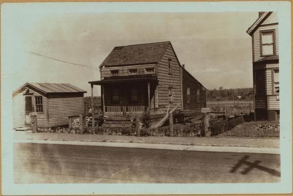
Richmond: Merrill Avenue - South Avenue

1932

Richmond: Merrill Avenue - South Avenue

Merrill Avenue (vantage point), north side, between South Avenue and Richmond Avenue, showing an old farmhouse and barns. Robinson's 1907 atlas indicates it to have been the John Denker farm. May 12, 1932 P. L. Sperr

Photo from the New York Public Library - Milstein Collection
View this location on the map →View on NYPL Digital Collections (opens in a new tab) →

More photos from this spot

  • Richmond: Richmond Avenue - Merrill Avenue

    1935

  • Richmond: Richmond Avenue - Merrill Avenue

    1932

  • Cemeteries - Merrill Cemetery - Staten Island

    1932

About and contactPrivacyPhotos: The New York Public Library, Milstein Collection