VVestiges of New York49,000+ historical photos
MapBrowseAboutGet the iPhone app (opens the App Store)
  1. Browse /
  2. Bronx /
  3. This place

Boston Road & 166th Street, Bronx

2 historical photos taken here between 1883 and 1901, oldest first.

See this spot on the map

Photos

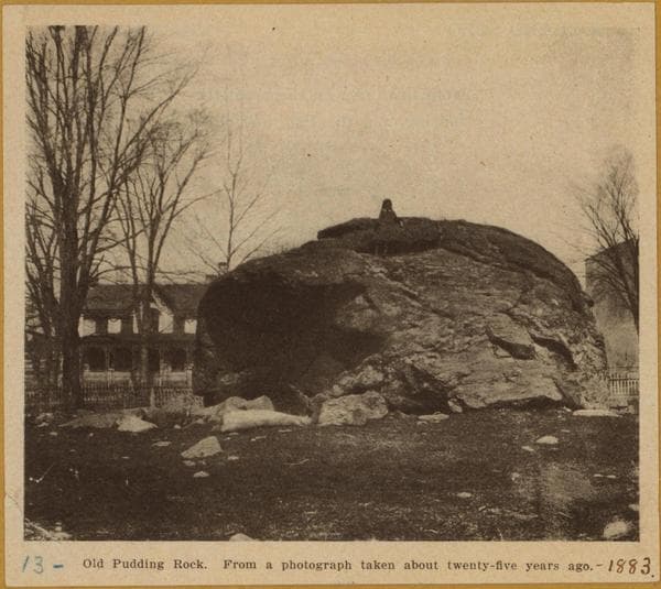
  • Bronx: Boston Road - 166th Street, 1883

    Bronx: Boston Road - 166th Street

    1883

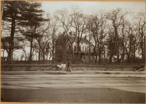
  • Bronx: Boston Road - 166th Street (East), 1901

    Bronx: Boston Road - 166th Street (East)

    1901

Stand where these photos were taken

The free OldNYC app for iPhone centers the map on you and shows the historical photos taken closest to where you are.
Download on the App Store (opens the App Store)
QR code that opens OldNYC on the App Store

Or scan with your iPhone

Nearby places

  • 3rd Avenue & East 168th Street, Bronx (5 photos)
  • East 168th Street, Bronx (3 photos)

Explore

  • Map
  • Browse by place
  • Browse by decade

Boroughs

  • Manhattan
  • Brooklyn
  • Queens
  • Bronx
  • Staten Island

About

  • About and contact
  • Privacy

Photos: The New York Public Library, Milstein Collection

OldNYC for iPhone

Find the historical photos taken closest to where you stand.

Download on the App Store (opens the App Store)QR code that opens OldNYC on the App Store
Bronx: Boston Road - 166th Street, 1883

Photo 1 of 2 at Boston Road & 166th Street, Bronx

Bronx: Boston Road - 166th Street

1883

13 - PUDDING ROCK, formerly on Boston Road and 166th Street. A truly immense glacial bowlder, rising 25 feet in the air, and being 30 feet in diameter. On one side was a natural fire-place, where the Indians used to enjoy their corn feasts and oyster banquets. Under its cool shade, the Huguenots rested on their long Sabbath Day journeys from New Rochelle down to the old French Protestant Church in lower New York. After serving as a natural landmark to early settlers and to travelers in stage coaches enroute from New York to Boston, it has finally been blasted into countless fragments so as no longer to "obstruct the march of civilization."

Photo from the New York Public Library - Milstein Collection

See this spot on the mapView on NYPL Digital Collections (opens in a new tab)

See this photo in high resolution

Zoom into the full-resolution scan in the OldNYC app for iPhone with OldNYC Supporter ($4.99). The free app also centers the map on you, so you can find the photos taken closest to where you stand.
Download on the App Store (opens the App Store)
QR code that opens OldNYC on the App Store

Or scan with your iPhone