VVestiges of New York49,000+ historical photos
MapBrowseAboutGet the iPhone app (opens the App Store)
  1. Browse /
  2. Bronx /
  3. This place

Bronxdale Avenue & Van Nest Avenue, Bronx

4 historical photos taken here between 1910 and 1940, oldest first.

See this spot on the map

Photos

  • Bronx: Bronxdale Avenue - Van Nest Avenue, 1910

    Bronx: Bronxdale Avenue - Van Nest Avenue

    1910

  • Bronx: Bronxdale Avenue - Van Nest Avenue, 1910

    Bronx: Bronxdale Avenue - Van Nest Avenue

    1910

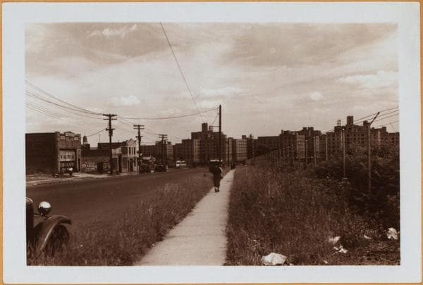
  • Bronx: Bronxdale Avenue - Van Nest Avenue, 1940

    Bronx: Bronxdale Avenue - Van Nest Avenue

    1940

  • Bronx: Bronxdale Avenue - south Van Nest Avenue ....

    Bronx: Bronxdale Avenue - south Van Nest Avenue ....

    Unknown

Stand where these photos were taken

The free OldNYC app for iPhone centers the map on you and shows the historical photos taken closest to where you are.
Download on the App Store (opens the App Store)
QR code that opens OldNYC on the App Store

Or scan with your iPhone

Nearby places

  • Fowler Avenue & Van Nest Avenue, Bronx (2 photos)
  • Morris Park Race Track, Bronx (4 photos)
  • Morris Park Avenue & Matthews Avenue, Bronx (4 photos)
  • Morris Park Avenue & Wallace Avenue, Bronx (3 photos)
  • Holland Avenue & Morris Park Avenue, Bronx (2 photos)
  • Rhinelander Avenue & Matthews Avenue, Bronx (6 photos)

Explore

  • Map
  • Browse by place
  • Browse by decade

Boroughs

  • Manhattan
  • Brooklyn
  • Queens
  • Bronx
  • Staten Island

About

  • About and contact
  • Privacy

Photos: The New York Public Library, Milstein Collection

OldNYC for iPhone

Find the historical photos taken closest to where you stand.

Download on the App Store (opens the App Store)QR code that opens OldNYC on the App Store
Bronx: Bronxdale Avenue - Van Nest Avenue, 1910

Photo 1 of 4 at Bronxdale Avenue & Van Nest Avenue, Bronx

Bronx: Bronxdale Avenue - Van Nest Avenue

1910

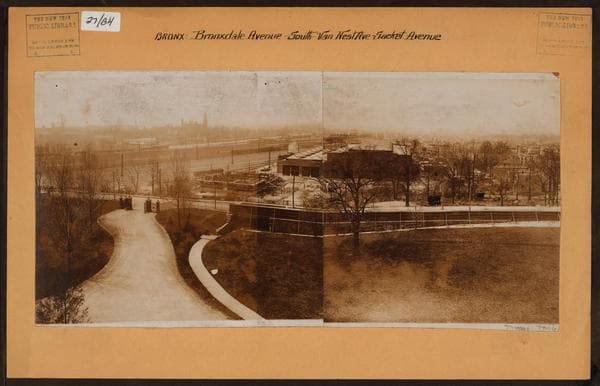
Bronxdale Ave. (running from right to left in front of park), south from Van Nest Ave. (right) to Sackett Ave., showing a general view, in a westerly direction, of the surrounding area as seen from the lower end of the Morris Park Race Track. In the center are the repair shops and extensive freight yards of the New York, New Haven and Hartford Railroad, extending west to the Unionport Road bridge over the tracks. Directly east of the bridge is visible the railroad's Van Nest station. The old Morris Park station was located on the empty lot directly in front of the repair shops and to the right of the store house seen under construction. The New Morris Park depot is situated on Sackett Ave., at Paulding Ave. About 1910.

Photo from the New York Public Library - Milstein Collection
See this spot on the mapView on NYPL Digital Collections (opens in a new tab)

See this photo in high resolution

Zoom into the full-resolution scan in the OldNYC app for iPhone with OldNYC Supporter ($4.99). The free app also centers the map on you, so you can find the photos taken closest to where you stand.
Download on the App Store (opens the App Store)
QR code that opens OldNYC on the App Store

Or scan with your iPhone