East 19th Street & Emmons Avenue, Brooklyn
15 historical photos taken here between 1922 and 1937, oldest first.
Photos
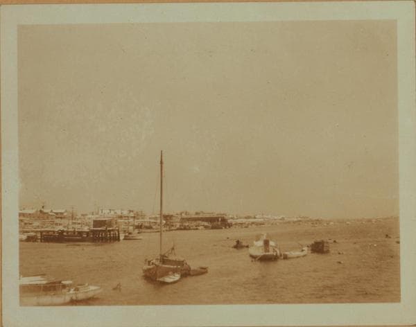
Sheepshead Bay - Brooklyn - East 19th Street.
1922; 1924
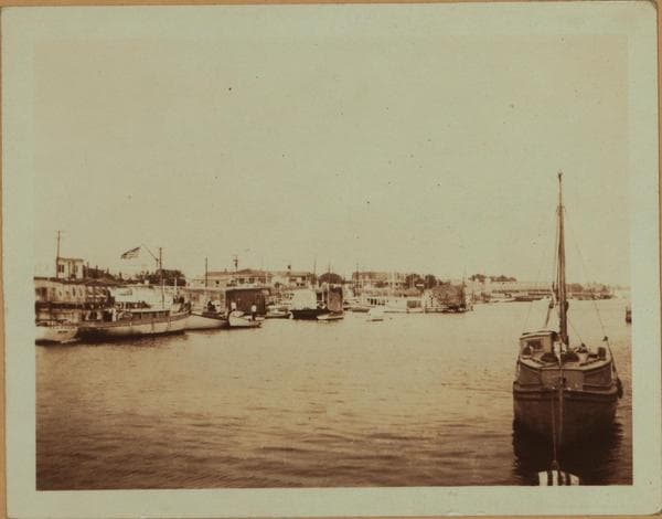
Sheepshead Bay - Brooklyn - East 19th Street.
1922; 1924

Brooklyn: 19th Street (East) - Emmons Avenue
1923; 1924; 1933
![Sheepshead Bay - Brooklyn - [Lundy Brothers Restaurant.], 1924–1935](/_next/image?url=https%3A%2F%2Fimages.vestigesofnewyork.com%2F600px%2F3d9796b9-b9a5-4a6c-bf40-e82169f610af.jpg&w=1080&q=75)
Sheepshead Bay - Brooklyn - [Lundy Brothers Restaurant.]
1924; 1933; 1935
![Sheepshead Bay - Brooklyn - [Lundy Brothers Restaurant.], 1924–1935](/_next/image?url=https%3A%2F%2Fimages.vestigesofnewyork.com%2F600px%2F44f2b2ae-c8a6-4aa3-9124-e5221e8eed6b.jpg&w=1080&q=75)
Sheepshead Bay - Brooklyn - [Lundy Brothers Restaurant.]
1924; 1933; 1935
![Sheepshead Bay - Brooklyn - [Lundy Brothers Restaurant.], 1924–1935](/_next/image?url=https%3A%2F%2Fimages.vestigesofnewyork.com%2F600px%2Fe320da59-ad3d-4506-b02d-24d98b7977eb.jpg&w=1080&q=75)
Sheepshead Bay - Brooklyn - [Lundy Brothers Restaurant.]
1924; 1933; 1935
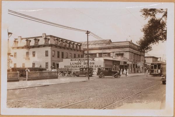
Brooklyn: Emmons Avenue - 19th Street (East)
![Sheepshead Bay - Brooklyn - East 19th Street - [Flying "D" - Lundy Brothers Restaurant.], 1933–1935](/_next/image?url=https%3A%2F%2Fimages.vestigesofnewyork.com%2F600px%2F3a52036f-3a8a-4d16-90f3-98439b065eb9.jpg&w=1080&q=75)
Sheepshead Bay - Brooklyn - East 19th Street - [Flying "D" - Lundy Brothers Restaurant.]
1933; 1935
![Sheepshead Bay - Brooklyn - [Emmons Avenue - Between 19th and 21st Streets (East) - Pier 12.], 1933–1937](/_next/image?url=https%3A%2F%2Fimages.vestigesofnewyork.com%2F600px%2F47d9dbdb-100a-4d70-9801-d250d21542a0.jpg&w=1080&q=75)
Sheepshead Bay - Brooklyn - [Emmons Avenue - Between 19th and 21st Streets (East) - Pier 12.]
1933; 1936; 1937
![Sheepshead Bay - Brooklyn - [Emmons Avenue - Between 19th and 21st Streets (East) - Pier 12.], 1933–1937](/_next/image?url=https%3A%2F%2Fimages.vestigesofnewyork.com%2F600px%2F58062a3d-b6df-438a-99fc-76f69255a7fa.jpg&w=1080&q=75)
Sheepshead Bay - Brooklyn - [Emmons Avenue - Between 19th and 21st Streets (East) - Pier 12.]
1933; 1936; 1937
![Sheepshead Bay - Brooklyn - East 19th Street - [Flying "D" - Lundy Brothers Restaurant.], 1933–1935](/_next/image?url=https%3A%2F%2Fimages.vestigesofnewyork.com%2F600px%2F6cecf20a-214b-4705-aaa0-f042d17aea7a.jpg&w=1080&q=75)
Sheepshead Bay - Brooklyn - East 19th Street - [Flying "D" - Lundy Brothers Restaurant.]
1933; 1935
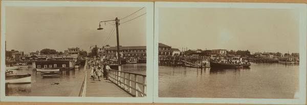
Sheepshead Bay - Brooklyn - between Sheepshead Road and Dooley Lane.
1933; 1935
![Sheepshead Bay - Brooklyn - [Emmons Avenue - Between 19th and 21st Streets (East) - Pier 12.], 1933–1937](/_next/image?url=https%3A%2F%2Fimages.vestigesofnewyork.com%2F600px%2F79f25446-0010-4463-99a9-f49b873251be.jpg&w=1080&q=75)
Sheepshead Bay - Brooklyn - [Emmons Avenue - Between 19th and 21st Streets (East) - Pier 12.]
1933; 1936; 1937
![Sheepshead Bay - Brooklyn - East 19th Street - [Flying "D" - Lundy Brothers Restaurant.], 1933–1935](/_next/image?url=https%3A%2F%2Fimages.vestigesofnewyork.com%2F600px%2Fca6b9410-127f-48e0-9832-161f5c9b9456.jpg&w=1080&q=75)
Sheepshead Bay - Brooklyn - East 19th Street - [Flying "D" - Lundy Brothers Restaurant.]
1933; 1935
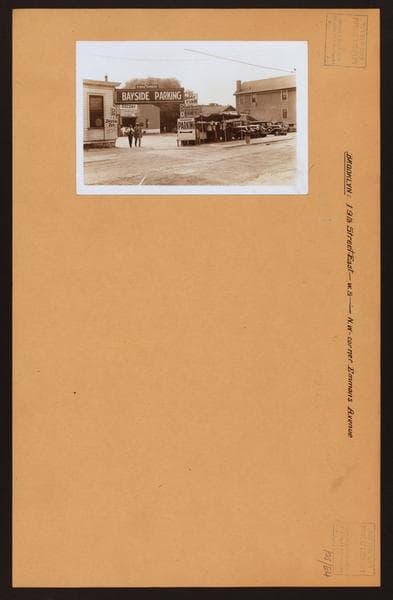
Brooklyn: 19th Street (East) - Emmons Avenue
Nearby places
- Emmons Avenue & Sheepshead Bay Road, Brooklyn (32 photos)
- Emmons Avenue & Ocean Avenue, Brooklyn (4 photos)
- Voorhies Ave & 18th St. E, Brooklyn (2 photos)
- Ocean Avenue & Voorhies Avenue, Brooklyn (7 photos)
- Shore Boulevard & Exeter Street, Brooklyn (5 photos)
- Emmons Avenue & East 22nd Street, Brooklyn (9 photos)
- Emmons Avenue & East 16th Street, Brooklyn (8 photos)
- Sheepshead Bay Road & Voorhies Avenue, Brooklyn (4 photos)