VVestiges of New York49,000+ historical photos
MapBrowseAboutGet the iPhone app (opens the App Store)
  1. Browse /
  2. Brooklyn /
  3. This place

Fulton Street & Wyona Street, Brooklyn

2 historical photos taken here between 1880 and 1922, oldest first.

See this spot on the map

Photos

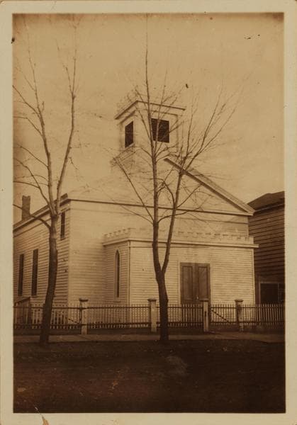
  • Brooklyn: Wyona St. - Fulton St., 1880

    Brooklyn: Wyona St. - Fulton St.

    1880

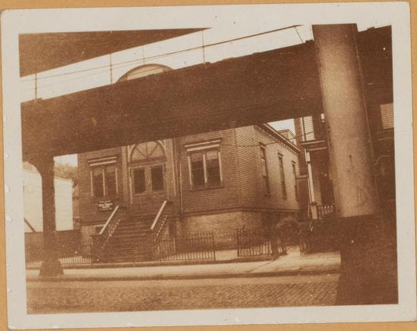
  • Brooklyn: Fulton Street - Wyona Street, 1922

    Brooklyn: Fulton Street - Wyona Street

    1922

Stand where these photos were taken

The free OldNYC app for iPhone centers the map on you and shows the historical photos taken closest to where you are.
Download on the App Store (opens the App Store)
QR code that opens OldNYC on the App Store

Or scan with your iPhone

Nearby places

  • Fulton Street & Bradford Street, Brooklyn (3 photos)
  • Wyona St & Jamaica Ave, Brooklyn (2 photos)
  • Fulton Street & New Jersey Avenue, Brooklyn (3 photos)
  • Atlantic Avenue & Wyona Street, Brooklyn (2 photos)
  • Atlantic Avenue & Vermont Street, Brooklyn (3 photos)
  • Liberty Avenue & Wyona Street, Brooklyn (2 photos)
  • Pennsylvania Avenue & Atlantic Avenue, Brooklyn (3 photos)
  • Bushwick Avenue & Jamaica Avenue, Brooklyn (2 photos)

Explore

  • Map
  • Browse by place
  • Browse by decade

Boroughs

  • Manhattan
  • Brooklyn
  • Queens
  • Bronx
  • Staten Island

About

  • About and contact
  • Privacy

Photos: The New York Public Library, Milstein Collection

OldNYC for iPhone

Find the historical photos taken closest to where you stand.

Download on the App Store (opens the App Store)QR code that opens OldNYC on the App Store
Brooklyn: Wyona St. - Fulton St., 1880

Photo 1 of 2 at Fulton Street & Wyona Street, Brooklyn

Brooklyn: Wyona St. - Fulton St.

1880

Wyona Ave., east side, between Fulton Street and Atlantic Ave., showing the Trinity Church (P.E.). Lyman Cobb, shortly after settling in East New York in 1850, organized the Episcopal Society, which in 1854 purchased this edifice from the Congregation of the Reformed Church. This structure built for church services in 1840, was no longer used as one in 1916. The real estate maps of 1929 show a 4-story brick building on the site. About 1880. Eugene L. Armbruster Collection. Negative available in LH&G: Neg. No. 175

Photo from the New York Public Library - Milstein Collection

See this spot on the mapView on NYPL Digital Collections (opens in a new tab)

See this photo in high resolution

Zoom into the full-resolution scan in the OldNYC app for iPhone with OldNYC Supporter ($4.99). The free app also centers the map on you, so you can find the photos taken closest to where you stand.
Download on the App Store (opens the App Store)
QR code that opens OldNYC on the App Store

Or scan with your iPhone