VVestiges of New York49,000+ historical photos
MapBrowseAboutGet the iPhone app (opens the App Store)
  1. Browse /
  2. Manhattan /
  3. This place

10th Street & Greenwich Avenue, Manhattan

13 historical photos taken here between 1927 and 1941, oldest first.

See this spot on the map

Photos

  • Manhattan: 10th Street - Greenwich Avenue, 1927

    Manhattan: 10th Street - Greenwich Avenue

    1927

  • Manhattan: 10th Street - Greenwich Avenue, 1927

    Manhattan: 10th Street - Greenwich Avenue
    1927

  • Manhattan: 10th Street - Greenwich Avenue, 1929–1933

    Manhattan: 10th Street - Greenwich Avenue

    1929; 1933
  • Manhattan: 10th Street - Greenwich Avenue, 1929

    Manhattan: 10th Street - Greenwich Avenue
    1929

  • Manhattan: Greenwich Avenue - 10th Street, 1929

    Manhattan: Greenwich Avenue - 10th Street
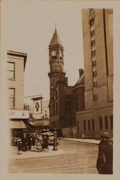
    1929

  • Manhattan: 10th Street - Greenwich Avenue, 1929–1933

    Manhattan: 10th Street - Greenwich Avenue

    1929; 1933

  • Manhattan: Greenwich Avenue - 10th Street (West), 1929

    Manhattan: Greenwich Avenue - 10th Street (West)
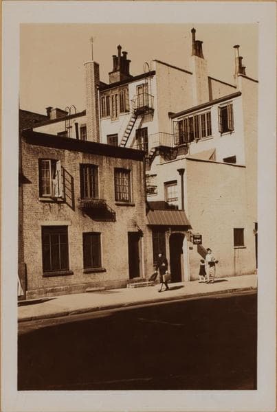
    1929

  • Manhattan: 10th Street - Greenwich Avenue, 1933–1937

    Manhattan: 10th Street - Greenwich Avenue

    1933; 1937
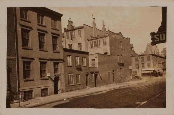
  • Manhattan: 10th Street - Greenwich Avenue, 1933–1937

    Manhattan: 10th Street - Greenwich Avenue

    1933; 1937

  • Manhattan: 10th Street - Greenwich Avenue, 1933–1941

    Manhattan: 10th Street - Greenwich Avenue

    1933; 1941
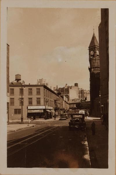
  • Manhattan: 10th Street - Greenwich Avenue, 1933–1941

    Manhattan: 10th Street - Greenwich Avenue

    1933; 1941
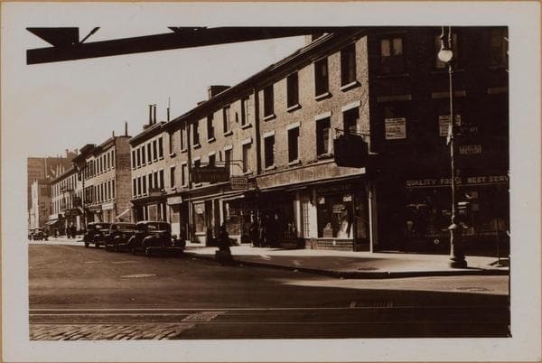
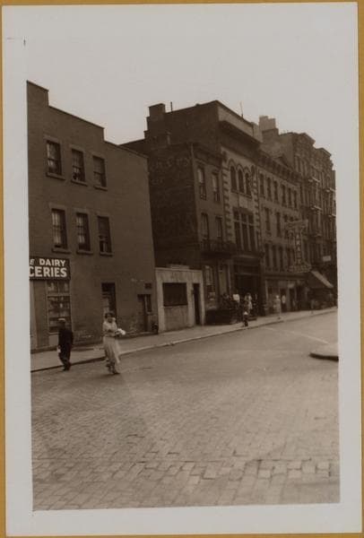
  • Manhattan: 10th Street (West) - Greenwich Avenue, 1938

    Manhattan: 10th Street (West) - Greenwich Avenue
    1938

  • Manhattan: 10th Street - Greenwich Avenue, 1941

    Manhattan: 10th Street - Greenwich Avenue

    1941

Stand where these photos were taken

The free OldNYC app for iPhone centers the map on you and shows the historical photos taken closest to where you are.
Download on the App Store (opens the App Store)
QR code that opens OldNYC on the App Store

Or scan with your iPhone

Nearby places

  • 6th Avenue & West 10th Street, Manhattan (26 photos)
  • 6th Avenue & Greenwich Avenue, Manhattan (38 photos)
  • 6th Avenue & West 9th Street, Manhattan (18 photos)
  • Christopher Street & Waverly Place, Manhattan (34 photos)
  • 6th Avenue & West 11th Street, Manhattan (21 photos)
  • 6th Avenue & 12th Street, Manhattan (7 photos)
  • 11th Street & Waverly Place, Manhattan (29 photos)
  • 7th Avenue & 10th Street, Manhattan (9 photos)

Explore

  • Map
  • Browse by place
  • Browse by decade

Boroughs

  • Manhattan
  • Brooklyn
  • Queens
  • Bronx
  • Staten Island

About

  • About and contact
  • Privacy

Photos: The New York Public Library, Milstein Collection

OldNYC for iPhone

Find the historical photos taken closest to where you stand.

Download on the App Store (opens the App Store)QR code that opens OldNYC on the App Store
Manhattan: 10th Street - Greenwich Avenue, 1929–1933

Photo 6 of 13 at 10th Street & Greenwich Avenue, Manhattan

Manhattan: 10th Street - Greenwich Avenue

1929; 1933

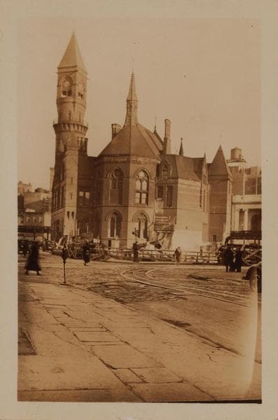
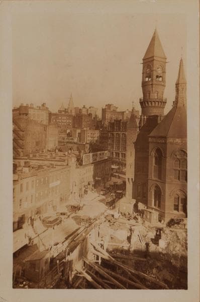
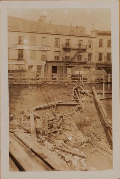
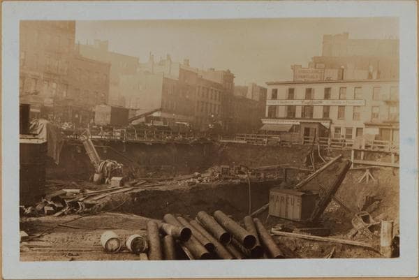
(1) Jefferson Market Courthouse and clock tower, with the excavation on the site of the old jail and the law and bail bond offices on the north side of 10th Street (formerly Amos Street), from Greenwich Avenue to Sixth Avenue. The courthouse, on the S.W. corner of Sixth Avenue and 10th Street, was erected in 1875. Prior to that there was a tall, roundish wooden tower, rather like a lighthouse in appearance, on the same site. The new House of Detention for Women is to be built in 1930-31, to fill the rest of the triangular block in which the courthouse stands. The break in the north side of 10th Street is the entrance to Patchin Place, a semi-private residential court. December 31, 1929 P.L. Sperr. (2) The same, showing only the N.E. corner at Greenwich Avenue and the south side to Sixth Avenue, three years later, with the new House of Detntion for Women on the site of the old jail. March 6, 1933 P.L. Sperr.

Photo from the New York Public Library - Milstein Collection

See this spot on the mapView on NYPL Digital Collections (opens in a new tab)

See this photo in high resolution

Zoom into the full-resolution scan in the OldNYC app for iPhone with OldNYC Supporter ($4.99). The free app also centers the map on you, so you can find the photos taken closest to where you stand.
Download on the App Store (opens the App Store)
QR code that opens OldNYC on the App Store

Or scan with your iPhone