VVestiges of New York49,000+ historical photos
MapBrowseAboutGet the iPhone app (opens the App Store)
  1. Browse /
  2. Manhattan /
  3. This place

11th Avenue & West 47th Street, Manhattan

4 historical photos taken here between 1931 and 1937, oldest first.

See this spot on the map

Photos

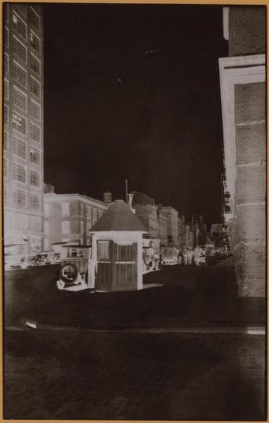
  • Manhattan: 11th Avenue - 47th Street (West), 1931

    Manhattan: 11th Avenue - 47th Street (West)

    1931

  • Manhattan: 11th Avenue - 47th Street (West), 1931

    Manhattan: 11th Avenue - 47th Street (West)

    1931

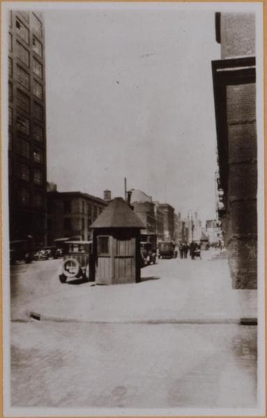
  • Manhattan: 47th Street (West) - [11th Avenue], 1932

    Manhattan: 47th Street (West) - [11th Avenue]

    1932

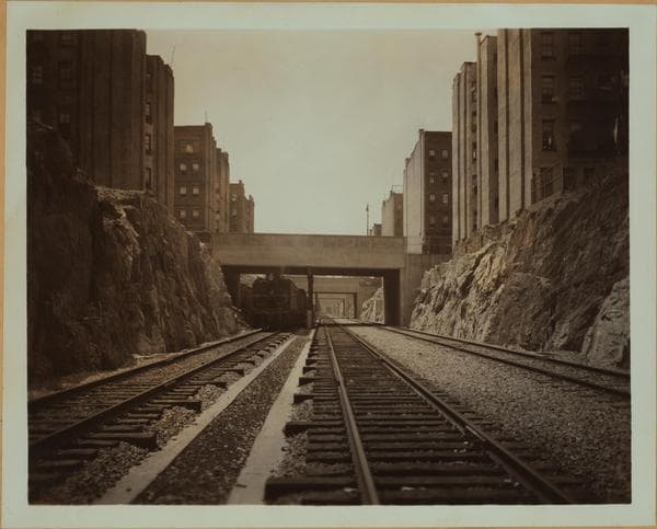
  • West Side Improvement Project., 1937

    West Side Improvement Project.

    1937

Stand where these photos were taken

The free OldNYC app for iPhone centers the map on you and shows the historical photos taken closest to where you are.
Download on the App Store (opens the App Store)
QR code that opens OldNYC on the App Store

Or scan with your iPhone

Nearby places

  • West 48th Street & 11th Avenue, Manhattan (5 photos)
  • 11th Avenue & West 46th Street, Manhattan (15 photos)
  • 11th Avenue & West 49th Street, Manhattan (19 photos)
  • West 45th Street & 11th Avenue, Manhattan (10 photos)
  • 12th Avenue & 47th Street, Manhattan (5 photos)
  • 11th Avenue & West 50th Street, Manhattan (10 photos)
  • 12th Avenue & 49th Street, Manhattan (9 photos)
  • 11th Avenue & West 44th Street, Manhattan (16 photos)

Explore

  • Map
  • Browse by place
  • Browse by decade

Boroughs

  • Manhattan
  • Brooklyn
  • Queens
  • Bronx
  • Staten Island

About

  • About and contact
  • Privacy

Photos: The New York Public Library, Milstein Collection

OldNYC for iPhone

Find the historical photos taken closest to where you stand.

Download on the App Store (opens the App Store)QR code that opens OldNYC on the App Store
West Side Improvement Project., 1937

Photo 4 of 4 at 11th Avenue & West 47th Street, Manhattan

West Side Improvement Project.

1937

West Side Improvement Project: The new roadbed of the New York Central Railroad that has been cut through solid rock for a depth of 25 feet, which connects several yards of this Company's and completes a rearrangement of the entire track layout on the west side of Manhattan. This feature is on the easterly side of Eleventh Ave. and connects the yards at 34th Street to those at 60th Street. Incidental to the construction of same, numerous buildings, factories and tenements were demolished. The photographer is viewing southward from a point under the West 47th Street bridge-like street level. July 24, 1937. Gift of New York Central System Publicity Bureau.

Photo from the New York Public Library - Milstein Collection
See this spot on the mapView on NYPL Digital Collections (opens in a new tab)

See this photo in high resolution

Zoom into the full-resolution scan in the OldNYC app for iPhone with OldNYC Supporter ($4.99). The free app also centers the map on you, so you can find the photos taken closest to where you stand.
Download on the App Store (opens the App Store)
QR code that opens OldNYC on the App Store

Or scan with your iPhone