VVestiges of New York49,000+ historical photos
MapBrowseAboutGet the iPhone app (opens the App Store)
  1. Browse /
  2. Manhattan /
  3. This place

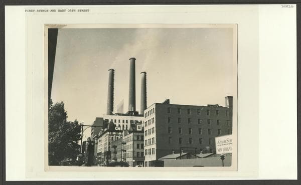
1st Ave & 35th St. E, Manhattan

19 historical photos taken here between 1930 and 1952, oldest first.

See this spot on the map

Photos

  • Manhattan: 1st Ave. - 35th St. E., 1930–1931

    Manhattan: 1st Ave. - 35th St. E.

    1930; 1931

  • Manhattan: 1st Ave. - 35th St. E., 1930–1931

    Manhattan: 1st Ave. - 35th St. E.

    1930; 1931

  • Manhattan: 1st Ave. - 35th St. E., 1931–1936

    Manhattan: 1st Ave. - 35th St. E.

    1931; 1936

  • Manhattan: 1st Ave. - 35th St. E., 1931–1936

    Manhattan: 1st Ave. - 35th St. E.

    1931; 1936

  • Manhattan: 1st Avenue - 35th Street (East), 1931

    Manhattan: 1st Avenue - 35th Street (East)

    1931

  • Manhattan: 1st Ave. - 35th St. E., 1931–1936

    Manhattan: 1st Ave. - 35th St. E.

    1931; 1936
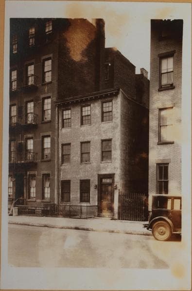
  • Manhattan: 35th Street (East) - 1st Avenue, 1932

    Manhattan: 35th Street (East) - 1st Avenue

    1932

  • Manhattan: 1st Avenue - 35th Street (East), 1934–1936

    Manhattan: 1st Avenue - 35th Street (East)

    1934; 1936

  • Manhattan: 1st Avenue - 35th Street (East), 1934–1936

    Manhattan: 1st Avenue - 35th Street (East)

    1934; 1936

  • Demolition in progress: 422-426 E. 35th St.-1st Av, Manhattan, 1934

    Demolition in progress: 422-426 E. 35th St.-1st Av, Manhattan
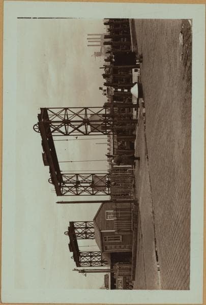
    1934

  • East River - shore and skyline ; Queensborough bridge ; Williamsburg bridge., 1938

    East River - shore and skyline ; Queensborough bridge ; Williamsburg bridge.

    1938

  • East River - shore and skyline ; Queensborough bridge ; Williamsburg bridge., 1938

    East River - shore and skyline ; Queensborough bridge ; Williamsburg bridge.

    1938

  • East River - shore and skyline ; Queensborough bridge ; Williamsburg bridge., 1938

    East River - shore and skyline ; Queensborough bridge ; Williamsburg bridge.

    1938

  • Manhattan: 35th Street (East) - 1st Avenue, 1939

    Manhattan: 35th Street (East) - 1st Avenue
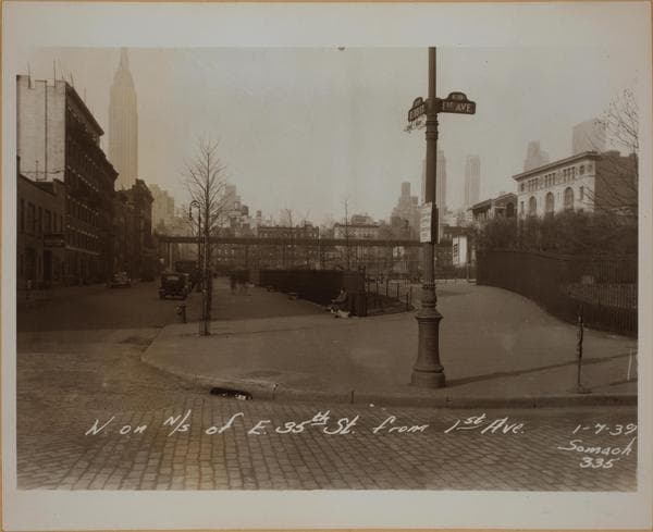
    1939

  • Manhattan: 35th Street (East) - 1st Avenue, 1939

    Manhattan: 35th Street (East) - 1st Avenue

    1939

  • Manhattan: 1st Ave. - 35th St. E., 1939

    Manhattan: 1st Ave. - 35th St. E.

    1939

  • Manhattan: 1st Ave. - 35th St. E., 1939

    Manhattan: 1st Ave. - 35th St. E.

    1939

  • Manhattan: 1st Ave. - 35th St. E., 1939

    Manhattan: 1st Ave. - 35th St. E.

    1939

  • First Avenue - 35th Street, 1952-06-08

    First Avenue - 35th Street

    1952-06-08

Stand where these photos were taken

The free OldNYC app for iPhone centers the map on you and shows the historical photos taken closest to where you are.
Download on the App Store (opens the App Store)
QR code that opens OldNYC on the App Store

Or scan with your iPhone

Nearby places

  • 1st Ave & 34th St. E, Manhattan (30 photos)
  • East 36th Street & 1st Avenue, Manhattan (54 photos)
  • 33rd Street & 1st Avenue, Manhattan (8 photos)
  • East 35th Street & 2nd Avenue, Manhattan (38 photos)
  • 37th Street & 1st Avenue, Manhattan (37 photos)
  • 1st Ave & 32nd St, Manhattan (7 photos)
  • East 33rd Street & 2nd Avenue, Manhattan (22 photos)
  • East 34th Street & 2nd Avenue, Manhattan (77 photos)

Explore

  • Map
  • Browse by place
  • Browse by decade

Boroughs

  • Manhattan
  • Brooklyn
  • Queens
  • Bronx
  • Staten Island

About

  • About and contact
  • Privacy

Photos: The New York Public Library, Milstein Collection

OldNYC for iPhone

Find the historical photos taken closest to where you stand.

Download on the App Store (opens the App Store)QR code that opens OldNYC on the App Store
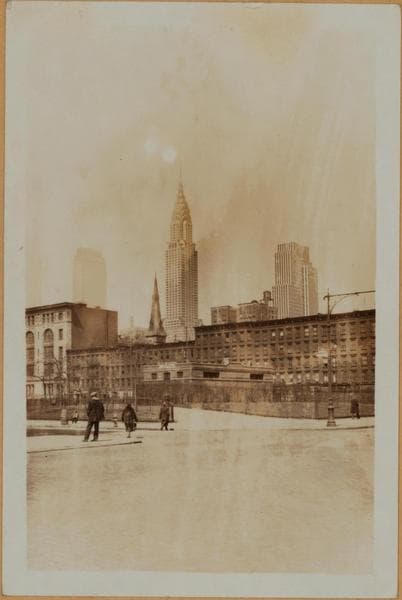
Manhattan: 1st Avenue - 35th Street (East), 1934–1936

Photo 9 of 19 at 1st Ave & 35th St. E, Manhattan

Manhattan: 1st Avenue - 35th Street (East)

1934; 1936

(1) St. Gabriel's Park, looking N.W. across the Park from 35th Street west of First Avenue. The five-story building on 36th Street is St. Gabriel's School; to the right of it may be seen the spire of St. Gabriel's Roman Catholic Church, which is on the south side of 37th Street. The Chrysler Building, Lexington Avenue and 42nd St., is almost directly in line with the church. The Chanin Building (122 East 42nd Street) and the Lincoln Building (60 East 42nd Street) rise on the horizon behind the school. June 14, 1934. P. L. Sperr. (2) A view of the western portion of the Park under improvement. Across same appears St. Gabriels Hall and the St. Gabriels Branch of the New York Public Library; both on 36th Street. Second Ave. (shown with elevated thereon) is the western boundary. Prominent structures, not shown in No. 1 are, 10 East 40th Street, and the Lefcourt Colonial. April 8, 1936. P. L. Sperr.

Photo from the New York Public Library - Milstein Collection

See this spot on the mapView on NYPL Digital Collections (opens in a new tab)

See this photo in high resolution

Zoom into the full-resolution scan in the OldNYC app for iPhone with OldNYC Supporter ($4.99). The free app also centers the map on you, so you can find the photos taken closest to where you stand.
Download on the App Store (opens the App Store)
QR code that opens OldNYC on the App Store

Or scan with your iPhone