VVestiges of New York49,000+ historical photos
MapBrowseAboutGet the iPhone app (opens the App Store)
  1. Browse /
  2. Manhattan /
  3. This place

7th Avenue & 116th Street, Manhattan

4 historical photos taken here between 1905 and 1941, oldest first.

See this spot on the map

Photos

  • Manhattan: St. Nicholas Avenue - 116th Street (West), 1905

    Manhattan: St. Nicholas Avenue - 116th Street (West)

    1905

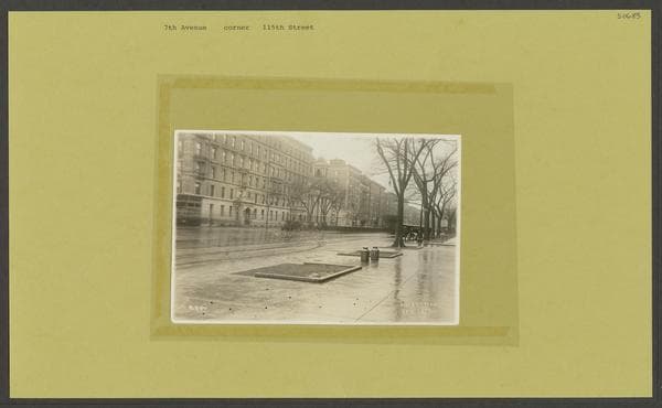
  • Seventh Avenue - 115th Street, 1920-06-08

    Seventh Avenue - 115th Street

    1920-06-08

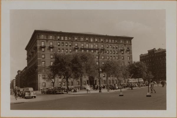
  • Manhattan: 7th Avenue - 116th Street, 1941

    Manhattan: 7th Avenue - 116th Street

    1941

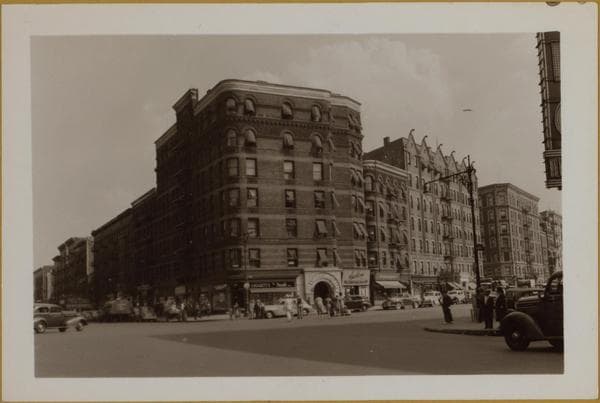
  • Manhattan: 7th Avenue - 116th Street, 1941

    Manhattan: 7th Avenue - 116th Street

    1941

Stand where these photos were taken

The free OldNYC app for iPhone centers the map on you and shows the historical photos taken closest to where you are.
Download on the App Store (opens the App Store)
QR code that opens OldNYC on the App Store

Or scan with your iPhone

Nearby places

  • 7th Avenue & 114th Street, Manhattan (9 photos)
  • St. Nicholas Avenue & West 117th Street, Manhattan (2 photos)
  • Dewey Square Hotel, view from above: W. 117th St.-7th…, Manhattan (3 photos)
  • West 116th Street & 8th Avenue, Manhattan (4 photos)
  • The Porthos and the Athos, 146-148 and 152-154 West 118th…, Manhattan (3 photos)
  • 118th Street & St. Nicholas Avenue, Manhattan (5 photos)
  • 7th Avenue & 112th Street, Manhattan (11 photos)
  • 8th Avenue & West 114th Street, Manhattan (4 photos)

Explore

  • Map
  • Browse by place
  • Browse by decade

Boroughs

  • Manhattan
  • Brooklyn
  • Queens
  • Bronx
  • Staten Island

About

  • About and contact
  • Privacy

Photos: The New York Public Library, Milstein Collection

OldNYC for iPhone

Find the historical photos taken closest to where you stand.

Download on the App Store (opens the App Store)QR code that opens OldNYC on the App Store
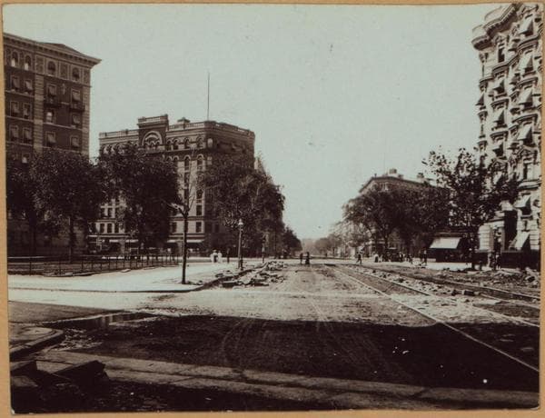
Manhattan: St. Nicholas Avenue - 116th Street (West), 1905

Photo 1 of 4 at 7th Avenue & 116th Street, Manhattan

Manhattan: St. Nicholas Avenue - 116th Street (West)

1905

St. Nicholas Ave. (car tracks thereon), south from West 117th Street and across Seventh Ave. at W. 116th Street (center), showing in the left foreground, a triangular grassy plot known as Kilpatrick Square. This is bounded on its three sides by Seventh Ave. (extreme left), West 117th Street (left foreground) and St. Nicholas Ave. (center foreground); its apex being at West 116th Street. This thoroughfare in earlier days was known as the Harlem Road to Kingsbridge and the easterly side of same followed the easterly side of the present Ave. as shown in the building line to the left. That on the right sets back approximately 30 feet; St. Nicholas Ave. being that much wider. The four corner apartment houses seen are, from left to right; the Graham Court (1923-37 Seventh Ave., east side, from 116th to 117th Streets); the Wilhelmina (1917-19 Seventh Ave., at the S.E. corner of 116th Street); the Acadia (No. 1889-93 Seventh Ave., and 91-97 St. Nicholas Ave., the apex at West 115th Street), and the Elnido (121 St. Nicholas Ave. and 201-5-11 West 116th Street, at the N.W. corner). June 1905 George L. Balgue

Photo from the New York Public Library - Milstein Collection
See this spot on the mapView on NYPL Digital Collections (opens in a new tab)

See this photo in high resolution

Zoom into the full-resolution scan in the OldNYC app for iPhone with OldNYC Supporter ($4.99). The free app also centers the map on you, so you can find the photos taken closest to where you stand.
Download on the App Store (opens the App Store)
QR code that opens OldNYC on the App Store

Or scan with your iPhone