VVestiges of New York49,000+ historical photos
MapBrowseAboutGet the iPhone app (opens the App Store)
  1. Browse /
  2. Manhattan /
  3. This place

Catherine Slip & South Street, Manhattan

22 historical photos taken here between 1870 and 1941, oldest first.

See this spot on the map

Photos

  • General view - Manhattan - [View of Lower Manhattan from Brooklyn Bridge.], 1870

    General view - Manhattan - [View of Lower Manhattan from Brooklyn Bridge.]

    1870

  • Manhattan: Catherine Slip - South Street, 1924–1927

    Manhattan: Catherine Slip - South Street

    1924; 1927
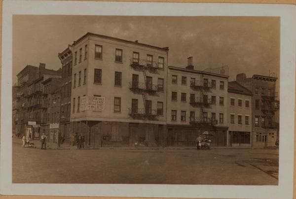
  • Manhattan: Catherine Slip - South Street, 1924–1927

    Manhattan: Catherine Slip - South Street

    1924; 1927
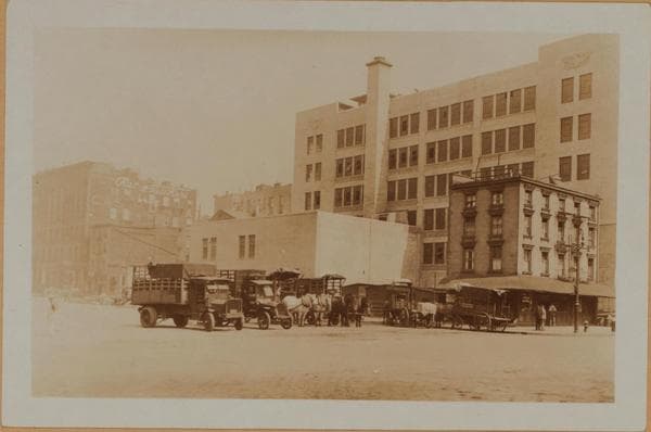
  • Manhattan: Catherine Slip - South Street, 1927

    Manhattan: Catherine Slip - South Street

    1927

  • Manhattan: Catherine Slip - South Street, 1927

    Manhattan: Catherine Slip - South Street

    1927

  • Manhattan: South Street - Catherine Slip, 1932–1933

    Manhattan: South Street - Catherine Slip

    1932; 1933
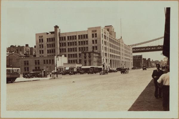
  • Manhattan: South Street - Catherine Slip, 1932–1933

    Manhattan: South Street - Catherine Slip

    1932; 1933

  • Manhattan: South Street - Catherine Slip, 1933

    Manhattan: South Street - Catherine Slip
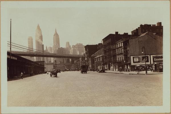
    1933

  • Manhattan: South Street - Catherine Slip, 1933

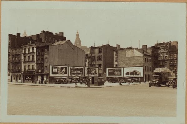
    Manhattan: South Street - Catherine Slip
    1933

  • Manhattan: South Street - Catherine Slip, 1933

    Manhattan: South Street - Catherine Slip

    1933

  • Manhattan: Catherine Slip - South Street, 1934

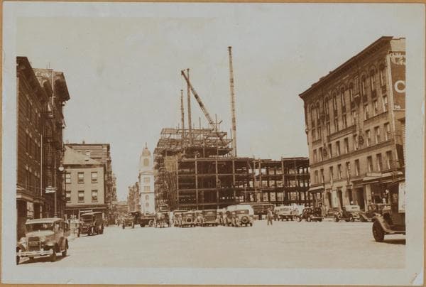
    Manhattan: Catherine Slip - South Street
    1934

  • Manhattan: Catherine Slip - South Street, 1934

    Manhattan: Catherine Slip - South Street

    1934

  • Manhattan: Catherine Slip - South Street, 1934

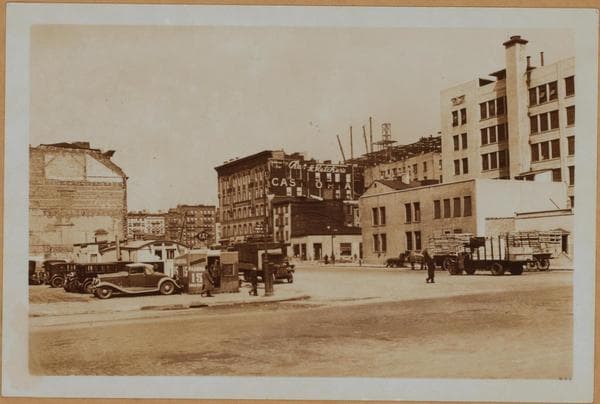
    Manhattan: Catherine Slip - South Street
    1934

  • Manhattan: Catherine Slip - South Street, 1934

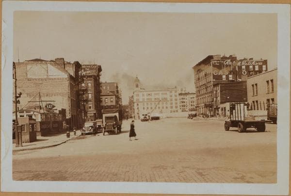
    Manhattan: Catherine Slip - South Street
    1934

  • Manhattan: Catherine Slip - South Street, 1934

    Manhattan: Catherine Slip - South Street

    1934

  • Manhattan: South Street - Catherine Slip, 1934

    Manhattan: South Street - Catherine Slip
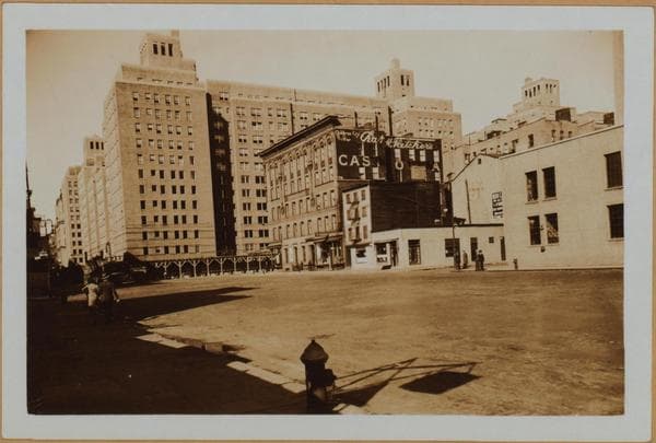
    1934

  • Manhattan: Catherine Slip - South Street, 1934

    Manhattan: Catherine Slip - South Street

    1934

  • Manhattan: Catherine Slip - South Street, 1934

    Manhattan: Catherine Slip - South Street

    1934

  • Manhattan: South Street - Catherine Slip, 1934

    Manhattan: South Street - Catherine Slip
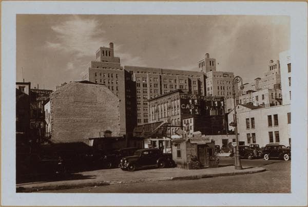
    1934

  • Manhattan: Catherine Slip - South Street, 1938

    Manhattan: Catherine Slip - South Street

    1938

  • Manhattan: Catherine Slip - South Street, 1938

    Manhattan: Catherine Slip - South Street
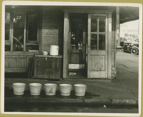
    1938

  • Catherine Slip - South Street, 1941-09-26

    Catherine Slip - South Street

    1941-09-26

Stand where these photos were taken

The free OldNYC app for iPhone centers the map on you and shows the historical photos taken closest to where you are.
Download on the App Store (opens the App Store)
QR code that opens OldNYC on the App Store

Or scan with your iPhone

Nearby places

  • South Street & Oliver Street, Manhattan (8 photos)
  • Water Street & Catherine Slip, Manhattan (10 photos)
  • Cherry Street & Catherine Street, Manhattan (22 photos)
  • South Street & James Slip, Manhattan (17 photos)
  • South Street & Market Slip, Manhattan (17 photos)
  • Cherry Street & James Street, Manhattan (34 photos)
  • Feast of San Rocco, Manhattan (6 photos)
  • Monroe Street & Catherine Street, Manhattan (25 photos)

Explore

  • Map
  • Browse by place
  • Browse by decade

Boroughs

  • Manhattan
  • Brooklyn
  • Queens
  • Bronx
  • Staten Island

About

  • About and contact
  • Privacy

Photos: The New York Public Library, Milstein Collection

OldNYC for iPhone

Find the historical photos taken closest to where you stand.

Download on the App Store (opens the App Store)QR code that opens OldNYC on the App Store
Manhattan: South Street - Catherine Slip, 1933

Photo 10 of 22 at Catherine Slip & South Street, Manhattan

Manhattan: South Street - Catherine Slip

1933

South Street, west from Catherine Slip to Roosevelt Street; at which point it makes a sharp turn southward. Also shown, is a portion of the Brooklyn Bridge. Across same (left to right), are the Farmer's Loan and Trust Co., No. 60 Wall Street Tower and the Bank of Manhattan Co. P. L. Sperr. The same, from another angle. Also shown, is Catherine Slip, at the N.W. corner of South Street (used as an automobile parking space), and Nos. 20 and 18. In the background are visible (left), the Woolworth Building and (right), the tower of the Municipal Building. June 22, 1933. P. L. Sperr. A portion of the same, showing only Nos. 199, 198 and 197 South Street (left). Also shown, is a more extensive view on Catherine Slip to Water Street. June 22, 1933. P. L. Sperr. According to the New York Times of December 21, 1937, the clearance at the aforementioned corner will be improved with a one story structure, and used as a gasoline station.

Photo from the New York Public Library - Milstein Collection

See this spot on the mapView on NYPL Digital Collections (opens in a new tab)

See this photo in high resolution

Zoom into the full-resolution scan in the OldNYC app for iPhone with OldNYC Supporter ($4.99). The free app also centers the map on you, so you can find the photos taken closest to where you stand.
Download on the App Store (opens the App Store)
QR code that opens OldNYC on the App Store

Or scan with your iPhone