Harlem River Drive & West 184th Street, Manhattan
15 historical photos taken here between 1932 and 1940, oldest first.
Photos
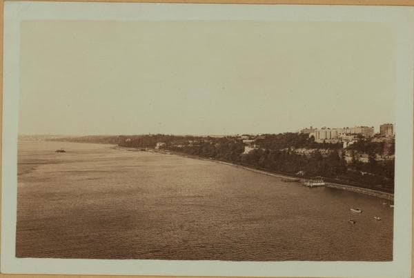
North (Hudson) River - shore and skyline - George Washington Bridge.
![Bridges - Washington Bridge [spanning the Harlem River from upper Manhattan at West 181st Street and Amsterdam Avenue to the Bronx.], 1932](/_next/image?url=https%3A%2F%2Fimages.vestigesofnewyork.com%2F600px%2Fd0b60629-3618-414a-abb6-bb78ec10161f.jpg&w=1080&q=75)
Bridges - Washington Bridge [spanning the Harlem River from upper Manhattan at West 181st Street and Amsterdam Avenue to the Bronx.]

North (Hudson) River - shore and skyline - George Washington Bridge.
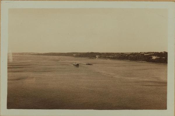
North (Hudson) River - shore and skyline - George Washington Bridge.
![Manhattan: High Bridge Park - [Amsterdam Avenue.], 1934](/_next/image?url=https%3A%2F%2Fimages.vestigesofnewyork.com%2F600px%2F47a2628c-4b87-4567-938b-b03cf3005283.jpg&w=1080&q=75)
Manhattan: High Bridge Park - [Amsterdam Avenue.]
![Manhattan: High Bridge Park - [Amsterdam Avenue.], 1934](/_next/image?url=https%3A%2F%2Fimages.vestigesofnewyork.com%2F600px%2F7e94b535-1121-4682-9518-e41d79830f3b.jpg&w=1080&q=75)
Manhattan: High Bridge Park - [Amsterdam Avenue.]
![Bridges - George Washington Bridge - [Connecting Manhattan at West 181st Street with Fort Lee, New Jersey.], 1936](/_next/image?url=https%3A%2F%2Fimages.vestigesofnewyork.com%2F600px%2F3a620cf5-ef9e-41d6-b899-eb881030d041.jpg&w=1080&q=75)
Bridges - George Washington Bridge - [Connecting Manhattan at West 181st Street with Fort Lee, New Jersey.]
![Bridges - George Washington Bridge - [Connecting Manhattan at West 181st Street with Fort Lee, New Jersey.], 1936](/_next/image?url=https%3A%2F%2Fimages.vestigesofnewyork.com%2F600px%2F8b169ce0-8148-4ff9-986b-1e449547ddf0.jpg&w=1080&q=75)
Bridges - George Washington Bridge - [Connecting Manhattan at West 181st Street with Fort Lee, New Jersey.]
![Bridges - George Washington Bridge - [Connecting Manhattan at West 181st Street with Fort Lee, New Jersey.], 1936](/_next/image?url=https%3A%2F%2Fimages.vestigesofnewyork.com%2F600px%2F92b67bde-8f68-4d5a-8947-837decbf291c.jpg&w=1080&q=75)
Bridges - George Washington Bridge - [Connecting Manhattan at West 181st Street with Fort Lee, New Jersey.]
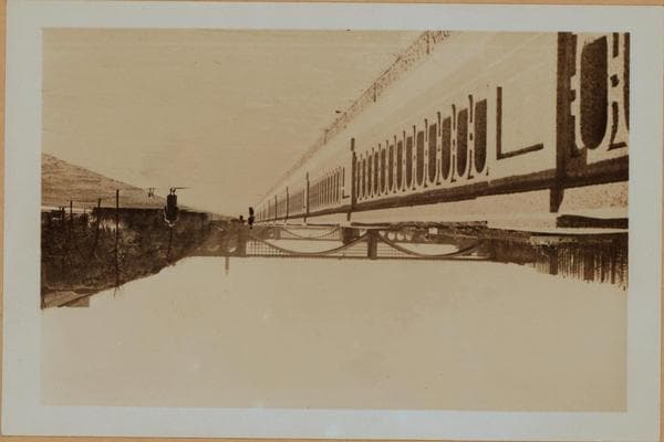
Manhattan: Harlem River Drive - 184th Street (West)

Manhattan: Harlem River Drive - 184th Street (West)

Manhattan: 135th Street (West) - Willis Avenue

Manhattan: 135th Street (West) - Willis Avenue
![Bridges - Washington Bridge - Harlem River - [High Bridge.], 1940](/_next/image?url=https%3A%2F%2Fimages.vestigesofnewyork.com%2F600px%2F1c4d84c5-4e51-426e-aa7e-7063d302769a.jpg&w=1080&q=75)
Bridges - Washington Bridge - Harlem River - [High Bridge.]
![Bridges - Washington Bridge - Harlem River - [High Bridge.], 1940](/_next/image?url=https%3A%2F%2Fimages.vestigesofnewyork.com%2F600px%2Fdde537c4-bbf3-4d65-bada-1e38faa8c01b.jpg&w=1080&q=75)
Bridges - Washington Bridge - Harlem River - [High Bridge.]
Nearby places
- The Eugene, 521-523 West 182nd Street, Manhattan (3 photos)
- Amsterdam Avenue & 183rd Street, Manhattan (3 photos)
- West 182nd Street & Audubon Avenue, Manhattan (7 photos)
- Amsterdam Avenue & 184th Street, Manhattan (2 photos)
- Fort Tryon Apartments, northeast corner St. Nicholas…, Manhattan (8 photos)
- Sedgwick Avenue & West 170th Street, Bronx (36 photos)
- West 185th Street & Audubon Avenue, Manhattan (3 photos)
- West 184th Street & St. Nicholas Avenue, Manhattan (3 photos)