VVestiges of New York49,000+ historical photos
MapBrowseAboutGet the iPhone app (opens the App Store)
  1. Browse /
  2. Manhattan /
  3. This place

Oliver Street & Henry Street, Manhattan

8 historical photos taken here between 1914 and 1937, oldest first.

See this spot on the map

Photos

  • Manhattan: Oliver Street - Henry Street, 1914–1927

    Manhattan: Oliver Street - Henry Street

    1914; 1927
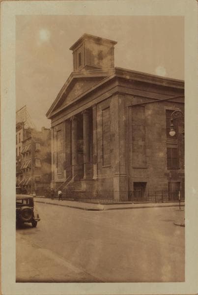
  • Manhattan: Oliver Street - Henry Street, 1914–1927

    Manhattan: Oliver Street - Henry Street

    1914; 1927
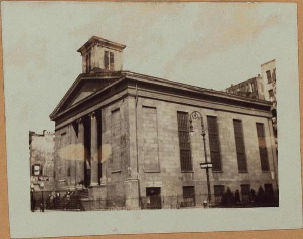
  • Manhattan: Oliver Street - Henry Street, 1914–1927

    Manhattan: Oliver Street - Henry Street

    1914; 1927

  • Manhattan: Henry Street - Oliver Street, 1920

    Manhattan: Henry Street - Oliver Street

    1920

  • Manhattan: Oliver Street - Henry Street, 1924–1931

    Manhattan: Oliver Street - Henry Street

    1924; 1927; 1931
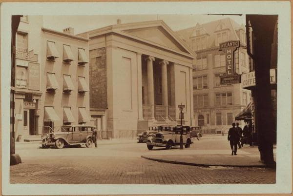
  • Manhattan: Oliver Street - Henry Street, 1924–1931

    Manhattan: Oliver Street - Henry Street

    1924; 1927; 1931
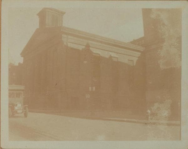
  • Manhattan: Oliver Street - Henry Street, 1924–1931

    Manhattan: Oliver Street - Henry Street

    1924; 1927; 1931

  • Manhattan: Oliver Street - [Henry Street.], 1937

    Manhattan: Oliver Street - [Henry Street.]

    1937

Stand where these photos were taken

The free OldNYC app for iPhone centers the map on you and shows the historical photos taken closest to where you are.
Download on the App Store (opens the App Store)
QR code that opens OldNYC on the App Store

Or scan with your iPhone

Nearby places

  • Catherine Street & East Broadway, Manhattan (3 photos)
  • Madison Street & Oliver Street, Manhattan (10 photos)
  • Downing Street & Doyers Street, Manhattan (42 photos)
  • Foley Square & 58th Street, Manhattan (17 photos)
  • James Street & Madison Street, Manhattan (6 photos)
  • Madison Street & Catherine Street, Manhattan (8 photos)
  • Park Row #168-70 & Baxter Street, Manhattan (2 photos)
  • Baxter Street & Worth Street, Manhattan (18 photos)

Explore

  • Map
  • Browse by place
  • Browse by decade

Boroughs

  • Manhattan
  • Brooklyn
  • Queens
  • Bronx
  • Staten Island

About

  • About and contact
  • Privacy

Photos: The New York Public Library, Milstein Collection

OldNYC for iPhone

Find the historical photos taken closest to where you stand.

Download on the App Store (opens the App Store)QR code that opens OldNYC on the App Store
Manhattan: Oliver Street - Henry Street, 1924–1931

Photo 6 of 8 at Oliver Street & Henry Street, Manhattan

Manhattan: Oliver Street - Henry Street

1924; 1927; 1931

(1) Oliver Street, east side, south from but not including Chatham Square, to and including Henry Street. The Baptist Mariners Temple is shown on the N.E. corner of Oliver at Henry Streets, with Public School No. 1 on the S.E. corner. June 12, 1931. P. L. Sperr. (2) The same, as seen from the Second and Third Aves., Elevated Station at Chatham Square. September 7, 1927. P. L. Sperr. (3) A view similar to No. 2, but in the opposite direction and showing the Henry Street side of the Church. The Oliver Street Baptist Temple was erected here in 1795 and was rebuilt in 1800 and again in 1819. It burned at a later date and was restored in 1843. It was known as the Mariner's Temple in 1909. Today (1937) it is the Evangelical Italian Church. 1924. Eugene L. Armbruster Collection.

Photo from the New York Public Library - Milstein Collection

See this spot on the mapView on NYPL Digital Collections (opens in a new tab)

See this photo in high resolution

Zoom into the full-resolution scan in the OldNYC app for iPhone with OldNYC Supporter ($4.99). The free app also centers the map on you, so you can find the photos taken closest to where you stand.
Download on the App Store (opens the App Store)
QR code that opens OldNYC on the App Store

Or scan with your iPhone