VVestiges of New York49,000+ historical photos
MapBrowseAboutGet the iPhone app (opens the App Store)
  1. Browse /
  2. Manhattan /
  3. This place

Riverside Drive & 127th Street, Manhattan

7 historical photos taken here between 1916 and 1930, oldest first.

See this spot on the map

Photos

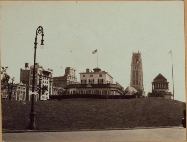
  • Manhattan: Riverside Drive - 127th Street, 1916–1930

    Manhattan: Riverside Drive - 127th Street

    1916; 1930

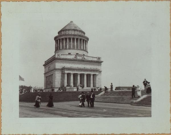
  • Manhattan: Riverside Drive - 127th Street, 1916–1930

    Manhattan: Riverside Drive - 127th Street

    1916; 1930

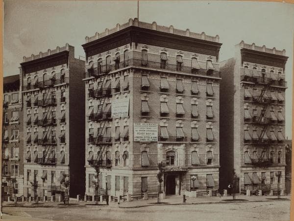
  • Manhattan: Riverside Drive - 127th Street, 1916–1930

    Manhattan: Riverside Drive - 127th Street

    1916; 1930

  • Manhattan: Riverside Drive - 127th Street, 1916–1930

    Manhattan: Riverside Drive - 127th Street

    1916; 1930

  • Manhattan: Riverside Drive - 127th Street, 1920

    Manhattan: Riverside Drive - 127th Street

    1920

  • North (Hudson) River - Shore and skyline - Manhattan - 59th Street - George Washington Bridge - [Claremont Inn.], 1926

    North (Hudson) River - Shore and skyline - Manhattan - 59th Street - George Washington Bridge - [Claremont Inn.]

    1926

  • Manhattan: Riverside Drive - 123rd Street, 1928

    Manhattan: Riverside Drive - 123rd Street

    1928

Stand where these photos were taken

The free OldNYC app for iPhone centers the map on you and shows the historical photos taken closest to where you are.
Download on the App Store (opens the App Store)
QR code that opens OldNYC on the App Store

Or scan with your iPhone

Nearby places

  • Claremont Court, 546 Riverside Drive, Manhattan (4 photos)
  • 125th Street & St. Clair Place, Manhattan (4 photos)
  • Tiemann Place & West 125th Street, Manhattan (6 photos)
  • Riverside Drive & St. Clair Place, Manhattan (2 photos)
  • Fairview Court, 175 Claremont Avenue, Manhattan (3 photos)
  • West 125th Street & 12th Avenue, Manhattan (2 photos)
  • La Salle Place & Broadway, Manhattan (18 photos)
  • Broadway & 125th Street, Manhattan (31 photos)

Explore

  • Map
  • Browse by place
  • Browse by decade

Boroughs

  • Manhattan
  • Brooklyn
  • Queens
  • Bronx
  • Staten Island

About

  • About and contact
  • Privacy

Photos: The New York Public Library, Milstein Collection

OldNYC for iPhone

Find the historical photos taken closest to where you stand.

Download on the App Store (opens the App Store)QR code that opens OldNYC on the App Store
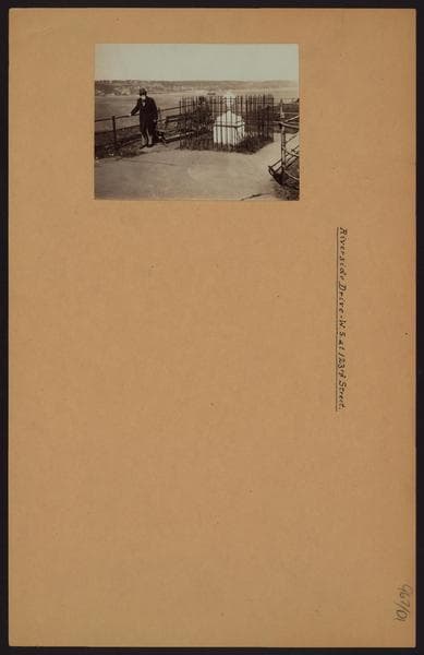
Manhattan: Riverside Drive - 123rd Street, 1928

Photo 7 of 7 at Riverside Drive & 127th Street, Manhattan

Manhattan: Riverside Drive - 123rd Street

1928

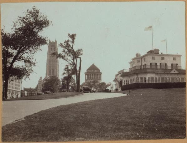
Riverside Drive, W.S., at 123rd Street near Grant's Tomb, showing a small monument. The inscription reads: Erected to the Memory of an Amiable Child St. Claire Pollock Died 15 July 1797 in the Fifth Year of His Age. Geo. L. Balgue 1928 The following text is taken from a photograph of Clermont Inn "Riverside Park S - Tiemann Place (W.127 St.)" 973/C2 Riverside park, south from Tiemann Place, (West 127th Street), showing the Clermont Inn on Riverside Drive. This structure was built before the Revolution, on land, sold August 4, 1796, by Nicholas de Peyster to George Pollock, a linen merchant who named the place for its beautiful trees and shrubbery, "Strawberry Hill." His 5 year old son, St. Claire Pollock, fell off the cliffs and was drowned July 15, 1797. His father subsequently went to New Orleans, where his descendants there, are said to be called Polk. His land, expressly reserving the burial place containing the urn of his boy, which may still be seen near Grant's Tomb, was sold in 1803 to Joseph Alston, the husband of medicosia Burr, who deeded it to Michael Hogan, the former British Consul at Havana. The latter named the place "Clermont" after the residence of the Earl of Clermont, Duke of Clarence, who became King William IV. The Earl of Devon, who resided here in 1807, was himself a cousin to Fulton’s "Clermont", and in 1815 an occupant was Joseph Bonaparte, the ex-King of Spain. The family bought the property, and since 1872 it has been a famous public restaurant. The land to the east and south of same is historical, being the scene of several of the sharpest engagements of the Battle of Harlem Heights on September 16, 1776. About 1907. Wurts Brothers.

Photo from the New York Public Library - Milstein Collection
See this spot on the mapView on NYPL Digital Collections (opens in a new tab)

See this photo in high resolution

Zoom into the full-resolution scan in the OldNYC app for iPhone with OldNYC Supporter ($4.99). The free app also centers the map on you, so you can find the photos taken closest to where you stand.
Download on the App Store (opens the App Store)
QR code that opens OldNYC on the App Store

Or scan with your iPhone