VVestiges of New York49,000+ historical photos
MapBrowseAboutGet the iPhone app (opens the App Store)
  1. Browse /
  2. Manhattan /
  3. This place

St. Nicholas Avenue & 159th Street, Manhattan

2 historical photos taken here between 1909 and 1934, oldest first.

See this spot on the map

Photos

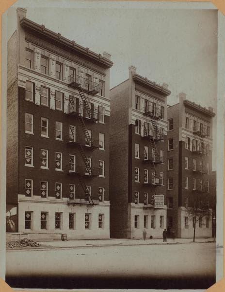
  • Manhattan: St. Nicholas Avenue - 159th Street, 1909

    Manhattan: St. Nicholas Avenue - 159th Street

    1909

  • Manhattan: St. Nicholas Avenue - 160th Street, 1934

    Manhattan: St. Nicholas Avenue - 160th Street

    1934

Stand where these photos were taken

The free OldNYC app for iPhone centers the map on you and shows the historical photos taken closest to where you are.
Download on the App Store (opens the App Store)
QR code that opens OldNYC on the App Store

Or scan with your iPhone

Nearby places

  • West 159th Street & Amsterdam Avenue, Manhattan (9 photos)
  • Sylvan Terrace & St. Nicholas Avenue, Manhattan (6 photos)
  • Jumel Terrace & Sylvan Terrace, Manhattan (6 photos)
  • West 160th Street & Amsterdam Avenue, Manhattan (9 photos)
  • Polo grounds, Manhattan (4 photos)
  • St. Nicholas Avenue & 158th Street, Manhattan (5 photos)
  • Edgecombe Avenue & West 160th Street, Manhattan (9 photos)
  • Edgecombe Avenue & West 162nd Street, Manhattan (5 photos)

Explore

  • Map
  • Browse by place
  • Browse by decade

Boroughs

  • Manhattan
  • Brooklyn
  • Queens
  • Bronx
  • Staten Island

About

  • About and contact
  • Privacy

Photos: The New York Public Library, Milstein Collection

OldNYC for iPhone

Find the historical photos taken closest to where you stand.

Download on the App Store (opens the App Store)QR code that opens OldNYC on the App Store
Manhattan: St. Nicholas Avenue - 160th Street, 1934

Photo 2 of 2 at St. Nicholas Avenue & 159th Street, Manhattan

Manhattan: St. Nicholas Avenue - 160th Street

1934

St. Nicholas Avenue, east side, from 162nd to 160th Streets, seen from Amsterdam Avenue at 162nd Street. The car tracks in the foreground are on Amsterdam Avenue. Between 161st and 160th Streets may be seen the western end of Sylvan Terrace (formerly Sylvan Place), with its two-story wooden houses, a real estate development of the early 1880's when this part of town was practically suburban. St. Nicholas Avenue in its present form had been laid out up to this point since around 1870. North from here it was still Kingsbridge Road. On the N.E. corner of 160th Street may be seen the Washington Heights Branch of the New York Public Library, 1000 St. Nicholas Avenue. October 12, 1934. P. L. Sperr.

Photo from the New York Public Library - Milstein Collection
See this spot on the mapView on NYPL Digital Collections (opens in a new tab)

See this photo in high resolution

Zoom into the full-resolution scan in the OldNYC app for iPhone with OldNYC Supporter ($4.99). The free app also centers the map on you, so you can find the photos taken closest to where you stand.
Download on the App Store (opens the App Store)
QR code that opens OldNYC on the App Store

Or scan with your iPhone