VVestiges of New York49,000+ historical photos
MapBrowseAboutGet the iPhone app (opens the App Store)
  1. Browse /
  2. Manhattan /
  3. This place

West Broadway & Bleecker Street, Manhattan

14 historical photos taken here between 1895 and 1945, oldest first.

See this spot on the map

Photos

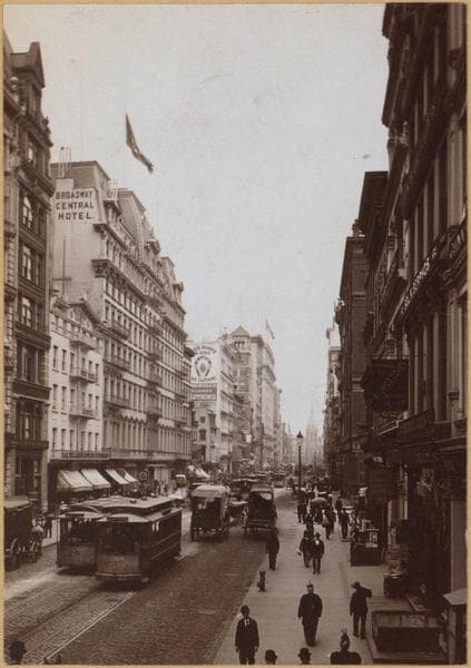
  • Manhattan: Broadway - Bleecker Street, 1895

    Manhattan: Broadway - Bleecker Street

    1895

  • Broadway, East Side. Bleecker to Third St., 1899

    Broadway, East Side. Bleecker to Third St.
    1899

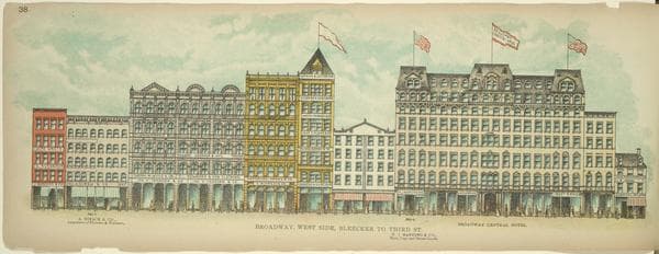
  • Broadway, West Side. Bleecker to Third St., 1899

    Broadway, West Side. Bleecker to Third St.

    1899

  • Manhattan: West Broadway - Bleecker Street, 1905

    Manhattan: West Broadway - Bleecker Street

    1905

  • Manhattan: Broadway - Bleecker Street, 1913

    Manhattan: Broadway - Bleecker Street

    1913

  • Transportation - Trolleys - [Horse drawn trolley cars run on Broadway line.], 1917

    Transportation - Trolleys - [Horse drawn trolley cars run on Broadway line.]
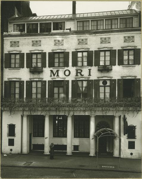
    1917

  • Manhattan: Bleecker Street - West Broadway., 1935

    Manhattan: Bleecker Street - West Broadway.

    1935

  • Manhattan: Bleecker Street - West Broadway, 1936

    Manhattan: Bleecker Street - West Broadway
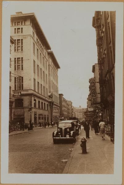
    1936

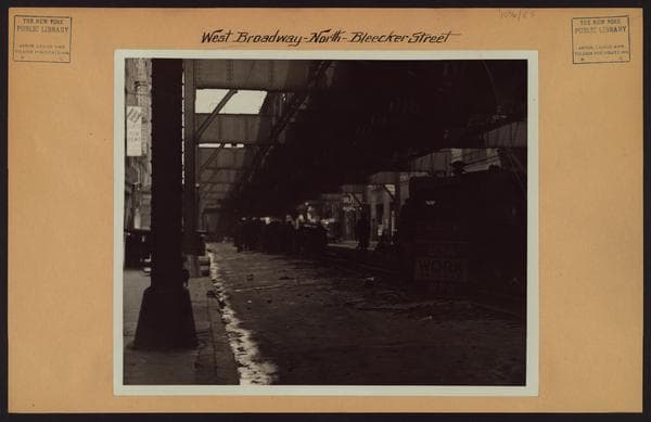
  • Manhattan: Bleecker Street - West Broadway, 1936

    Manhattan: Bleecker Street - West Broadway
    1936

  • Manhattan: West Broadway - Bleecker Street, 1936

    Manhattan: West Broadway - Bleecker Street

    1936

  • Manhattan: West Broadway - Bleecker Street, 1938–1939

    Manhattan: West Broadway - Bleecker Street

    1938; 1939
  • Manhattan: West Broadway - Bleecker Street, 1938–1939

    Manhattan: West Broadway - Bleecker Street

    1938; 1939
  • Manhattan: West Broadway - Bleecker Street, 1938–1939

    Manhattan: West Broadway - Bleecker Street

    1938; 1939

  • Manhattan: Broadway - [Bleecker Street], 1945

    Manhattan: Broadway - [Bleecker Street]

    1945

Stand where these photos were taken

The free OldNYC app for iPhone centers the map on you and shows the historical photos taken closest to where you are.
Download on the App Store (opens the App Store)
QR code that opens OldNYC on the App Store

Or scan with your iPhone

Nearby places

  • Broadway & Bond Street, Manhattan (2 photos)
  • Bleecker Street & Mercer Street, Manhattan (5 photos)
  • West Broadway & West 3rd Street, Manhattan (19 photos)
  • Lafayette Street & Bleecker Street, Manhattan (17 photos)
  • Lafayette Street & Great Jones Street, Manhattan (18 photos)
  • Parades, Manhattan (5 photos)
  • Bleecker Street & Wooster Street, Manhattan (6 photos)
  • Houston Street (West & Greene Street, Manhattan (20 photos)

Explore

  • Map
  • Browse by place
  • Browse by decade

Boroughs

  • Manhattan
  • Brooklyn
  • Queens
  • Bronx
  • Staten Island

About

  • About and contact
  • Privacy

Photos: The New York Public Library, Milstein Collection

OldNYC for iPhone

Find the historical photos taken closest to where you stand.

Download on the App Store (opens the App Store)QR code that opens OldNYC on the App Store
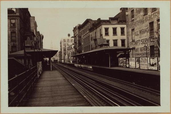
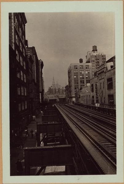
Manhattan: West Broadway - Bleecker Street, 1938–1939

Photo 11 of 14 at West Broadway & Bleecker Street, Manhattan

Manhattan: West Broadway - Bleecker Street

1938; 1939

West Broadway, north from the Bleecker Street platform of the Sixth Avenue Elevated line, to Washington Square. On the horizon, beyond that point appears the Metropolitan, New York Life and Chrysler Buildings. Note the westward bend on W. 3rd Street of this transportation line. Civic authorities at this time have filed notice of demolition for the complete Sixth Avenue Elevated line and same will shortly disappear from the Manhattan scene; its services being performed by the about to be completed Sixth Avenue Municipal Subway. May 23, 1938. Views 1 and 2 P. L. Sperr The same thoroughfare subsequent to the "El" demolition. Note the distinctive apartment house, No. 1 Fifth Avenue, in the background. Washington Square intervenes between this point and the end of this street. May 19, 1939 P. L. Sperr

Photo from the New York Public Library - Milstein Collection

See this spot on the mapView on NYPL Digital Collections (opens in a new tab)

See this photo in high resolution

Zoom into the full-resolution scan in the OldNYC app for iPhone with OldNYC Supporter ($4.99). The free app also centers the map on you, so you can find the photos taken closest to where you stand.
Download on the App Store (opens the App Store)
QR code that opens OldNYC on the App Store

Or scan with your iPhone