VVestiges of New York49,000+ historical photos
MapBrowseAboutGet the iPhone app (opens the App Store)
  1. Browse /
  2. Manhattan /
  3. This place

York Avenue & 66th Street, Manhattan

9 historical photos taken here between 1920 and 1933, oldest first.

See this spot on the map

Photos

  • Manhattan: 66th Street (East) - York Avenue, 1920

    Manhattan: 66th Street (East) - York Avenue

    1920

  • Manhattan: York Avenue - 66th Street, 1928–1933

    Manhattan: York Avenue - 66th Street

    1928; 1933

  • Manhattan: York Avenue - 66th Street, 1928–1933

    Manhattan: York Avenue - 66th Street

    1928; 1933

  • Manhattan: York Avenue - 66th Street, 1930

    Manhattan: York Avenue - 66th Street

    1930

  • Manhattan: York Avenue - 66th Street, 1930

    Manhattan: York Avenue - 66th Street

    1930

  • Manhattan: York Avenue - 66th Street, 1931

    Manhattan: York Avenue - 66th Street

    1931

  • East 66th Street - York Avenue, 1931

    East 66th Street - York Avenue

    1931

  • Manhattan: York Avenue - 66th Street, 1933

    Manhattan: York Avenue - 66th Street

    1933

  • Manhattan: York Avenue - 66th Street, 1933

    Manhattan: York Avenue - 66th Street

    1933

Stand where these photos were taken

The free OldNYC app for iPhone centers the map on you and shows the historical photos taken closest to where you are.
Download on the App Store (opens the App Store)
QR code that opens OldNYC on the App Store

Or scan with your iPhone

Nearby places

  • York Avenue & 64th Street, Manhattan (13 photos)
  • York Avenue & 68th Street, Manhattan (42 photos)
  • 1st Ave & 66th St, Manhattan (2 photos)
  • 1st Ave & 67th St. E, Manhattan (10 photos)
  • York Avenue & East 63rd Street, Manhattan (27 photos)
  • York Avenue & 69th Street, Manhattan (7 photos)
  • East 69th Street & 1st Avenue, Manhattan (7 photos)
  • East 70th Street & Marie Curie Avenue, Manhattan (2 photos)

Explore

  • Map
  • Browse by place
  • Browse by decade

Boroughs

  • Manhattan
  • Brooklyn
  • Queens
  • Bronx
  • Staten Island

About

  • About and contact
  • Privacy

Photos: The New York Public Library, Milstein Collection

OldNYC for iPhone

Find the historical photos taken closest to where you stand.

Download on the App Store (opens the App Store)QR code that opens OldNYC on the App Store
Manhattan: York Avenue - 66th Street, 1928–1933

Photo 3 of 9 at York Avenue & 66th Street, Manhattan

Manhattan: York Avenue - 66th Street

1928; 1933

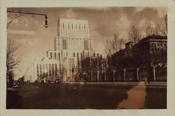
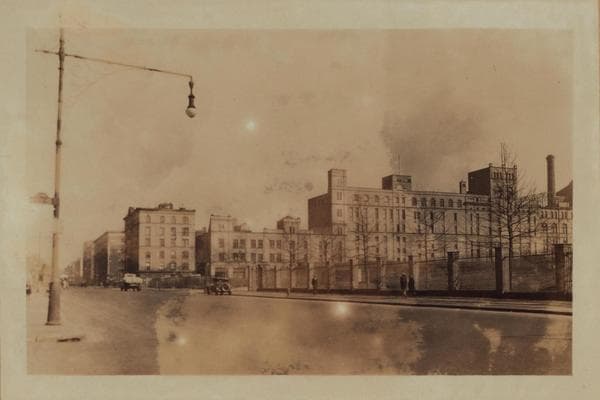
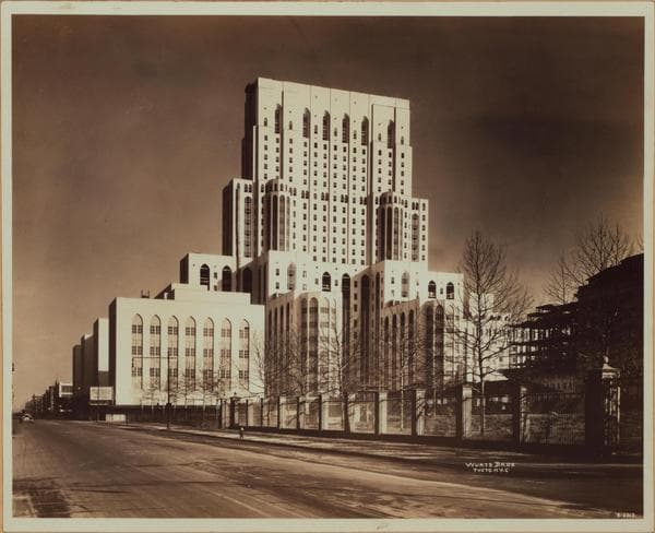
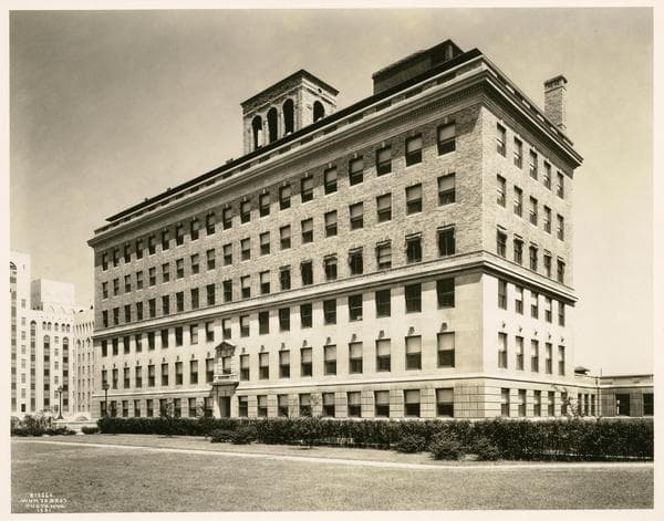
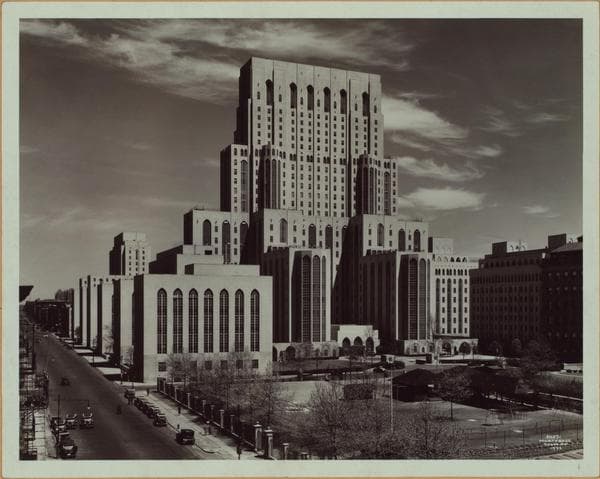
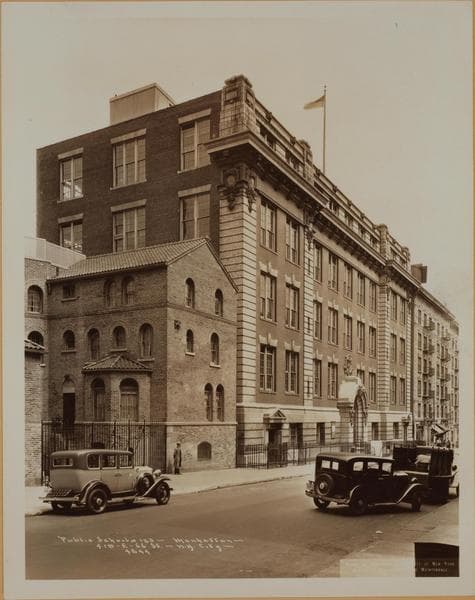
(1) York Avenue (Avenue A), east side, north from 66th Street. In the right foreground are the grounds of the Rockefeller Institute, which extend up to 67th Street. The block above, where the Williams stone yards used to be around 1890-1900, is a children's playground. On the N.W. corner of 68th Street is the old Central, an apartment house built in 1902. East of it, on 68th Street, are the stables and garage, and then the main plant, of the Central Brewing Company, erected around 1900-02. In this block, prior to about 1895, was Jones Woods Coliseum, known in its last few years as Empire City Coliseum. From 69th to 70th Streets may be seen old 1294-1304 Avenue A, tenements built prior to 1910. From 70th to 71st Streets are houses built, in their original form, from about 1890-95, and used for some years as cigar factories. February 13, 1928. P. L. Sperr. (2) York Avenue, east side, north from 66th Street, the same view as the preceding. The lamp post in the left foreground, in both pictures, is on the N.W. corner of 66th Street. Rockefeller Institute now has the entire property east of York Avenue up to 68th Street. Notice their fence, with its stone posts. The building to the north is the newest laboratory, built in 1930. The New York Hospital and Cornell Medical College takes up the entire three blocks from 66th to 71st Streets, and east to Exterior Street, which is shortly to be rechristened Marie Curie Avenue. The Bio-Chemistry and Pharmacy Wing is located on the very N.W. corner of 68th Street where the old Century apartment house used to stand. Compare these two views with Wurts Brothers' view of the same scene early in 1931. March 5, 1933. P. L. Sperr. THE NEW YORK PUBLIC LIBRARY

Photo from the New York Public Library - Milstein Collection
See this spot on the mapView on NYPL Digital Collections (opens in a new tab)

See this photo in high resolution

Zoom into the full-resolution scan in the OldNYC app for iPhone with OldNYC Supporter ($4.99). The free app also centers the map on you, so you can find the photos taken closest to where you stand.
Download on the App Store (opens the App Store)
QR code that opens OldNYC on the App Store

Or scan with your iPhone