VVestiges of New York49,000+ historical photos
MapBrowseAboutGet the iPhone app (opens the App Store)
  1. Browse /
  2. Manhattan /
  3. This place

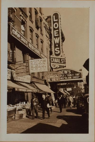
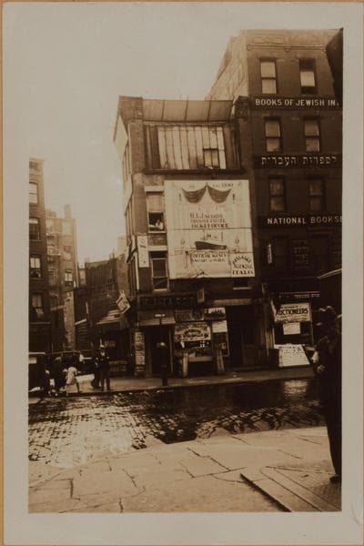
Canal Street & Ludlow Street, Manhattan

9 historical photos taken here between 1927 and 1939, oldest first.

See this spot on the map

Photos

  • Manhattan: Canal Street - Division Street, 1927–1935

    Manhattan: Canal Street - Division Street

    1927; 1934; 1935

  • Manhattan: Canal Street - Division Street, 1927–1935

    Manhattan: Canal Street - Division Street

    1927; 1934; 1935

  • Manhattan: Canal Street - Division Street, 1927–1935

    Manhattan: Canal Street - Division Street

    1927; 1934; 1935

  • Manhattan: Canal Street - Ludlow Street, 1930

    Manhattan: Canal Street - Ludlow Street

    1930

  • Manhattan: Canal Street - Ludlow Street, 1930

    Manhattan: Canal Street - Ludlow Street

    1930

  • Manhattan: Canal Street - Ludlow Street, 1930

    Manhattan: Canal Street - Ludlow Street

    1930

  • Manhattan: Canal Street - Ludlow Street, 1935

    Manhattan: Canal Street - Ludlow Street

    1935

  • Manhattan: Division Street - Canal Street, 1939

    Manhattan: Division Street - Canal Street

    1939

  • Manhattan: Division Street - Canal Street, 1939

    Manhattan: Division Street - Canal Street

    1939

Stand where these photos were taken

The free OldNYC app for iPhone centers the map on you and shows the historical photos taken closest to where you are.
Download on the App Store (opens the App Store)
QR code that opens OldNYC on the App Store

Or scan with your iPhone

Nearby places

  • Canal Street & Orchard Street, Manhattan (15 photos)
  • Hester Street & Orchard Street, Manhattan (6 photos)
  • Essex Street & Hester Street, Manhattan (28 photos)
  • Allen Street & Hester Street, Manhattan (8 photos)
  • Essex Street & Canal Street, Manhattan (13 photos)
  • Division Street & Orchard Street, Manhattan (6 photos)
  • Norfolk Street & Hester Street, Manhattan (18 photos)
  • Allen Street & Canal Street, Manhattan (15 photos)

Explore

  • Map
  • Browse by place
  • Browse by decade

Boroughs

  • Manhattan
  • Brooklyn
  • Queens
  • Bronx
  • Staten Island

About

  • About and contact
  • Privacy

Photos: The New York Public Library, Milstein Collection

OldNYC for iPhone

Find the historical photos taken closest to where you stand.

Download on the App Store (opens the App Store)QR code that opens OldNYC on the App Store
Manhattan: Canal Street - Ludlow Street, 1930

Photo 4 of 9 at Canal Street & Ludlow Street, Manhattan

Manhattan: Canal Street - Ludlow Street

1930

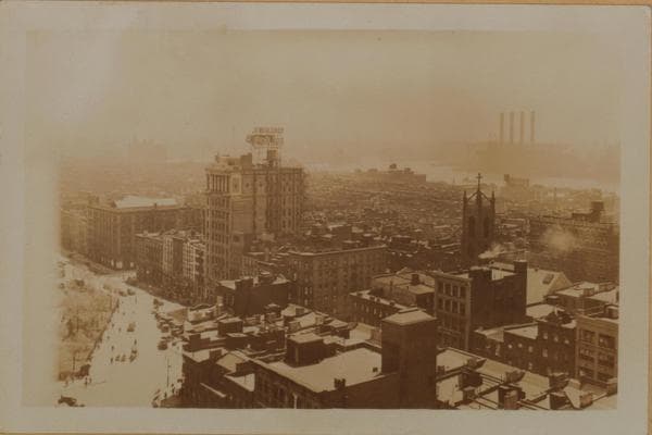
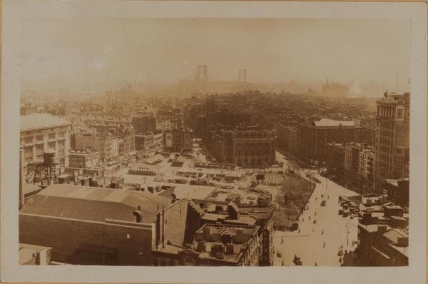
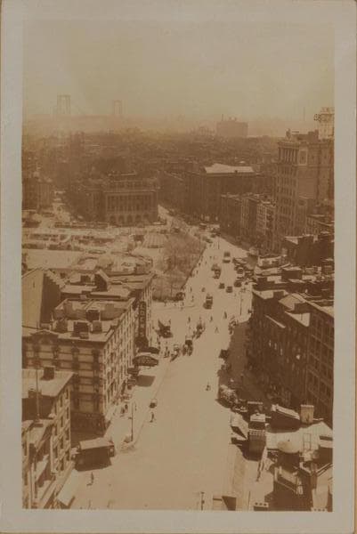
(1) Canal Street (running from foreground to rear) east from and in- cluding Ludlow Street (left fore, where truck is visible), to and including East Broadway (where it terminates), and showing the latter thoroughfare forming approximately a 160 degree angle and proceeding, essentially, in the same (eastward) direction. Also shown (center of view) is Seward Park extending from Essex, east to Jefferson Streets. Across same, appears the Seward Park branch of the New York Public Library, on the east side of Jefferson Street, from East Broadway to Division Street. In the right foreground are shown Nos. 135 to 143 Division Street, south side, where it meets Canal Street. It suspends its course there and resumes again at the eastern edge of the park, at the library. This picture was taken from the 12-story building No. 54-58 Canal Street, at the S.W. corner of Orchard Street and includes a panoramic view of the surrounding area with the Williamsburg Bridge in the distance. May 9, 1930. P. L. Sperr. (2) The same, showing a more inclusive view. Note (on the right) the 10-story Jewish Daily Forward Building, 173-175 East Broadway, and slightly eastward, at the S.E. corner of Jefferson Street, the 5-story Educational Alliance Building. May 9, 1930. P. L. Sperr. (3) The same, from a different angle and viewed in a southeasterly direction, showing the East River and the Brooklyn shore. At the right appears the steeple of St. Teresa's R.C. Church, at the N.W. corner of Rutgers and Henry Streets. May 9, 1930. P. L. Sperr.

Photo from the New York Public Library - Milstein Collection
See this spot on the mapView on NYPL Digital Collections (opens in a new tab)

See this photo in high resolution

Zoom into the full-resolution scan in the OldNYC app for iPhone with OldNYC Supporter ($4.99). The free app also centers the map on you, so you can find the photos taken closest to where you stand.
Download on the App Store (opens the App Store)
QR code that opens OldNYC on the App Store

Or scan with your iPhone