VVestiges of New York49,000+ historical photos
MapBrowseAboutGet the iPhone app (opens the App Store)
  1. Browse /
  2. Manhattan /
  3. This place

West 57th Street & 11th Avenue, Manhattan

16 historical photos taken here between 1933 and 1937, oldest first.

See this spot on the map

Photos

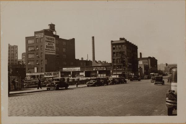
  • Manhattan: 57th Street (West) - 11th Avenue, 1933

    Manhattan: 57th Street (West) - 11th Avenue

    1933

  • Manhattan: 11th Avenue - 57th Street, 1933

    Manhattan: 11th Avenue - 57th Street

    1933

  • Manhattan: 11th Avenue - 57th Street, 1933

    Manhattan: 11th Avenue - 57th Street

    1933

  • Manhattan: 11th Avenue - 57th Street, 1933–1936

    Manhattan: 11th Avenue - 57th Street

    1933; 1936
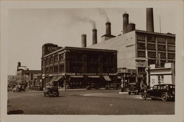
  • Manhattan: 57th Street (West) - 11th Avenue, 1933

    Manhattan: 57th Street (West) - 11th Avenue
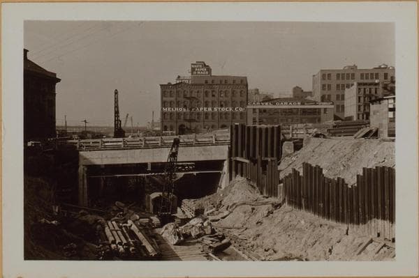
    1933

  • Manhattan: 57th Street (West) - 11th Avenue, 1933–1936

    Manhattan: 57th Street (West) - 11th Avenue

    1933; 1936
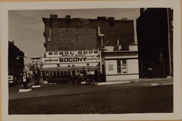
  • Manhattan: 57th Street (West) - 11th Avenue, 1933–1936

    Manhattan: 57th Street (West) - 11th Avenue

    1933; 1936
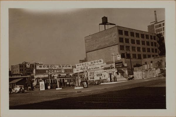
  • Manhattan: 57th Street (West) - 11th Avenue, 1933–1936

    Manhattan: 57th Street (West) - 11th Avenue

    1933; 1936
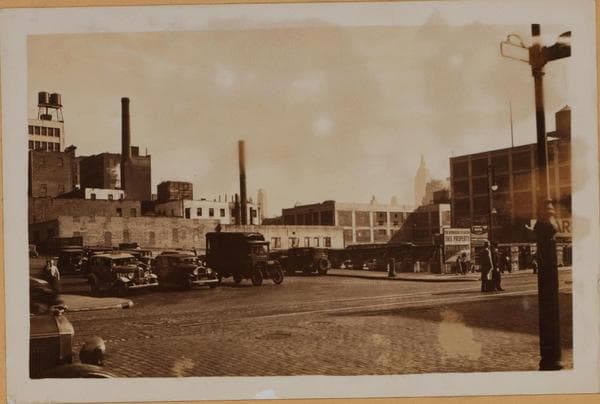
  • Manhattan: 11th Avenue - 57th Street, 1933–1936

    Manhattan: 11th Avenue - 57th Street

    1933; 1936
  • 602-604 West 57th Street - Eleventh Avenue, 1935-10

    602-604 West 57th Street - Eleventh Avenue
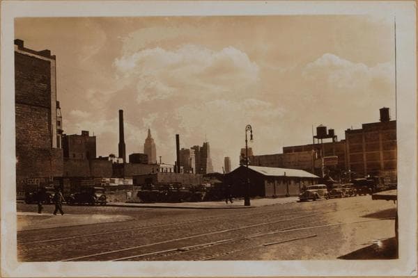
    1935-10

  • Manhattan: 11th Avenue - 57th Street, 1935

    Manhattan: 11th Avenue - 57th Street

    1935

  • 602-604 West 57th Street - Eleventh Avenue, 1935-10

    602-604 West 57th Street - Eleventh Avenue
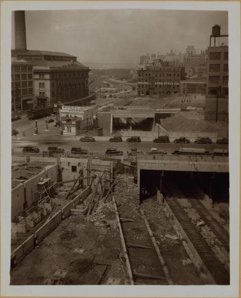
    1935-10

  • Manhattan: 57th Street (West) - 11th Avenue, 1937

    Manhattan: 57th Street (West) - 11th Avenue

    1937

  • West Side Improvement Project., 1937

    West Side Improvement Project.

    1937

  • Manhattan: 57th Street (West) - 11th Avenue, 1937

    Manhattan: 57th Street (West) - 11th Avenue
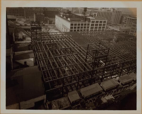
    1937

  • Manhattan: 57th Street (West) - 11th Avenue, 1937

    Manhattan: 57th Street (West) - 11th Avenue

    1937

Stand where these photos were taken

The free OldNYC app for iPhone centers the map on you and shows the historical photos taken closest to where you are.
Download on the App Store (opens the App Store)
QR code that opens OldNYC on the App Store

Or scan with your iPhone

Nearby places

  • 11th Avenue & 56th Street, Manhattan (9 photos)
  • 11th Avenue & West 58th Street, Manhattan (9 photos)
  • West 55th Street & 11th Avenue, Manhattan (5 photos)
  • 10th Avenue & 57th Street, Manhattan (2 photos)
  • West End Avenue & West 60th Street, Manhattan (24 photos)
  • 10th Avenue & 58th Street, Manhattan (12 photos)
  • 12th Avenue & 56th Street, Manhattan (5 photos)
  • West 55th Street & 10th Avenue, Manhattan (4 photos)

Explore

  • Map
  • Browse by place
  • Browse by decade

Boroughs

  • Manhattan
  • Brooklyn
  • Queens
  • Bronx
  • Staten Island

About

  • About and contact
  • Privacy

Photos: The New York Public Library, Milstein Collection

OldNYC for iPhone

Find the historical photos taken closest to where you stand.

Download on the App Store (opens the App Store)QR code that opens OldNYC on the App Store
Manhattan: 57th Street (West) - 11th Avenue, 1933–1936

Photo 7 of 16 at West 57th Street & 11th Avenue, Manhattan

Manhattan: 57th Street (West) - 11th Avenue

1933; 1936

West 57th Street, at the N.E. corner of Eleventh Avenue (left), showing a gasoline station at this location. Surrounding same are tenements on 57th Street (right) and Eleventh Avenue which are gone in view No. 2, as the diagonal underpass of the New York Central Railroad is being cut thru here so as to pass under Eleventh Avenue to the 59th Street yards. View No. 3 shows this phase with 58th Street being bridged in the foreground. Note the I.R.T. power house at the extreme left. For further views of this Railroad improvement, see the files under the West Side Improvement Project. October 3, 1933 Views 2 & 3: May 21, 1936.

Photo from the New York Public Library - Milstein Collection

See this spot on the mapView on NYPL Digital Collections (opens in a new tab)

See this photo in high resolution

Zoom into the full-resolution scan in the OldNYC app for iPhone with OldNYC Supporter ($4.99). The free app also centers the map on you, so you can find the photos taken closest to where you stand.
Download on the App Store (opens the App Store)
QR code that opens OldNYC on the App Store

Or scan with your iPhone