VVestiges of New York49,000+ historical photos
MapBrowseAboutGet the iPhone app (opens the App Store)
  1. Browse /
  2. Queens /
  3. This place

31st Street & 24th Avenue, Queens

3 historical photos taken here in 1934, oldest first.

See this spot on the map

Photos

  • Queens: 31st Street - 24th Avenue, 1934

    Queens: 31st Street - 24th Avenue

    1934

  • Queens: 31st Street - 24th Avenue, 1934

    Queens: 31st Street - 24th Avenue

    1934

  • Queens: 31st Street - 24th Avenue, 1934

    Queens: 31st Street - 24th Avenue

    1934

Stand where these photos were taken

The free OldNYC app for iPhone centers the map on you and shows the historical photos taken closest to where you are.
Download on the App Store (opens the App Store)
QR code that opens OldNYC on the App Store

Or scan with your iPhone

Nearby places

  • 33rd Street & 24th Avenue, Queens (2 photos)
  • Hoyt Avenue & 31st Street, Queens (20 photos)
  • Astoria Boulevard & 34th Street, Queens (2 photos)
  • Hoyt Avenue & 29th Street, Queens (10 photos)
  • Astoria Boulevard & 32nd Street, Queens (3 photos)
  • Astoria Boulevard & 37th Avenue, Queens (4 photos)
  • Grand Central Parkway & 31st Street, Queens (3 photos)
  • 28th Street & Hoyt Avenue, Queens (3 photos)

Explore

  • Map
  • Browse by place
  • Browse by decade

Boroughs

  • Manhattan
  • Brooklyn
  • Queens
  • Bronx
  • Staten Island

About

  • About and contact
  • Privacy

Photos: The New York Public Library, Milstein Collection

OldNYC for iPhone

Find the historical photos taken closest to where you stand.

Download on the App Store (opens the App Store)QR code that opens OldNYC on the App Store
Queens: 31st Street - 24th Avenue, 1934

Photo 2 of 3 at 31st Street & 24th Avenue, Queens

Queens: 31st Street - 24th Avenue

1934

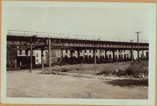
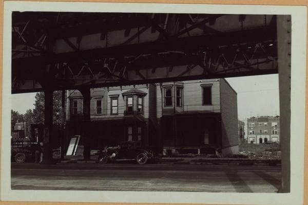
31st Street, west side, between 24th and Hoyt Avenues, showing a group of two-story homes being demolished, where a public playground was later built. View 1 is south from the former Dorothy Place toward Hoyt Avenue; view 2 is across the I.R.T. elevated from 24th Road, just east of 31st Street; view 3 shows frame houses at the S.W. corner of 24th Road. P. L. Sperr September 20, 1934 Views 1,2,3

Photo from the New York Public Library - Milstein Collection

See this spot on the mapView on NYPL Digital Collections (opens in a new tab)

See this photo in high resolution

Zoom into the full-resolution scan in the OldNYC app for iPhone with OldNYC Supporter ($4.99). The free app also centers the map on you, so you can find the photos taken closest to where you stand.
Download on the App Store (opens the App Store)
QR code that opens OldNYC on the App Store

Or scan with your iPhone