VVestiges of New York49,000+ historical photos
MapBrowseAboutGet the iPhone app (opens the App Store)
  1. Browse /
  2. Queens /
  3. This place

94th Street & 23rd Avenue, Queens

25 historical photos taken here between 1900 and 1939, oldest first.

See this spot on the map

Photos

  • Queens: 94th Street - 23rd Avenue, 1900

    Queens: 94th Street - 23rd Avenue

    1900

  • Queens: 94th Street - 23rd Avenue, 1900

    Queens: 94th Street - 23rd Avenue

    1900

  • Queens: 94th Street - 23rd Avenue, 1923–1929

    Queens: 94th Street - 23rd Avenue

    1923; 1929
  • Queens: 94th Street - 23rd Avenue, 1923–1929

    Queens: 94th Street - 23rd Avenue

    1923; 1929
  • Queens: 94th Street - 23rd Avenue, 1923–1929

    Queens: 94th Street - 23rd Avenue

    1923; 1929
  • Queens: 94th Street - 23rd Avenue, 1923–1929

    Queens: 94th Street - 23rd Avenue

    1923; 1929
  • Queens: 94th Street - 23rd Avenue, 1923–1929

    Queens: 94th Street - 23rd Avenue

    1923; 1929
  • Queens: 94th Street - 23rd Avenue, 1923–1929

    Queens: 94th Street - 23rd Avenue

    1923; 1925; 1929
  • Queens: 94th Street - 23rd Avenue, 1923–1929

    Queens: 94th Street - 23rd Avenue

    1923; 1925; 1929

  • Queens: 94th Street - 23rd Avenue, 1923–1929

    Queens: 94th Street - 23rd Avenue

    1923; 1929
  • Queens: 94th Street - 23rd Avenue, 1923–1929

    Queens: 94th Street - 23rd Avenue

    1923; 1929
  • Queens: 94th Street - 23rd Avenue, 1923–1929

    Queens: 94th Street - 23rd Avenue

    1923; 1925; 1929
  • Queens: 94th Street - 23rd Avenue, 1923–1929

    Queens: 94th Street - 23rd Avenue

    1923; 1929
  • Queens: 94th Street - 23rd Avenue, 1923–1929

    Queens: 94th Street - 23rd Avenue

    1923; 1925; 1929
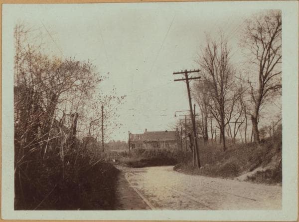
  • Queens: 94th Street - 23rd Avenue, 1923–1929

    Queens: 94th Street - 23rd Avenue

    1923; 1929
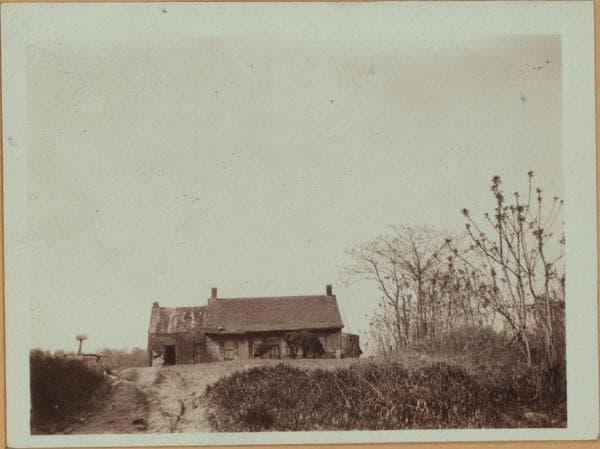
  • Queens: 94th Street - 23rd Avenue, 1923–1929

    Queens: 94th Street - 23rd Avenue

    1923; 1929
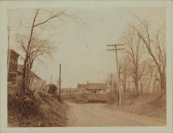
  • Queens: 94th Street - 23rd Avenue, 1923–1929

    Queens: 94th Street - 23rd Avenue

    1923; 1929
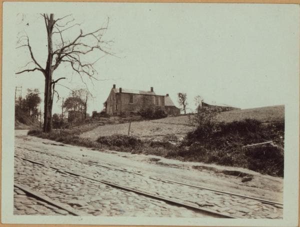
  • Queens: 94th Street - 23rd Avenue, 1923–1929

    Queens: 94th Street - 23rd Avenue

    1923; 1929
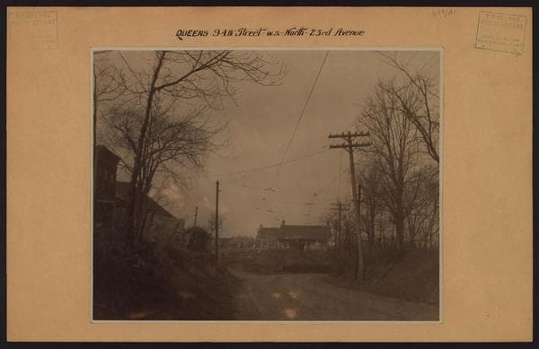
  • Queens: 94th Street - 23rd Avenue, 1932

    Queens: 94th Street - 23rd Avenue

    1932

  • Queens: 94th Street - 23rd Avenue, 1935

    Queens: 94th Street - 23rd Avenue

    1935

  • Queens: 94th Street - 23rd Avenue, 1935

    Queens: 94th Street - 23rd Avenue

    1935

  • Queens: 94th Street - 23rd Avenue, 1935

    Queens: 94th Street - 23rd Avenue

    1935

  • Queens: 94th Street - 23rd Avenue, 1939

    Queens: 94th Street - 23rd Avenue

    1939

  • Queens: 94th Street - 23rd Avenue, 1939

    Queens: 94th Street - 23rd Avenue

    1939

  • Queens: 94th Street - 23rd Avenue, 1939

    Queens: 94th Street - 23rd Avenue

    1939

Stand where these photos were taken

The free OldNYC app for iPhone centers the map on you and shows the historical photos taken closest to where you are.
Download on the App Store (opens the App Store)
QR code that opens OldNYC on the App Store

Or scan with your iPhone

Nearby places

  • 94th Street & 24th Avenue, Queens (4 photos)
  • 94th Street & Ditmars Boulevard, Queens (16 photos)
  • 24th Avenue & 93rd Street, Queens (2 photos)
  • 93rd Street & Ditmars Boulevard, Queens (2 photos)
  • Ditmars Boulevard & 100th Street, Queens (4 photos)

Explore

  • Map
  • Browse by place
  • Browse by decade

Boroughs

  • Manhattan
  • Brooklyn
  • Queens
  • Bronx
  • Staten Island

About

  • About and contact
  • Privacy

Photos: The New York Public Library, Milstein Collection

OldNYC for iPhone

Find the historical photos taken closest to where you stand.

Download on the App Store (opens the App Store)QR code that opens OldNYC on the App Store
Queens: 94th Street - 23rd Avenue, 1923–1929

Photo 15 of 25 at 94th Street & 23rd Avenue, Queens

Queens: 94th Street - 23rd Avenue

1923; 1929

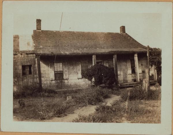
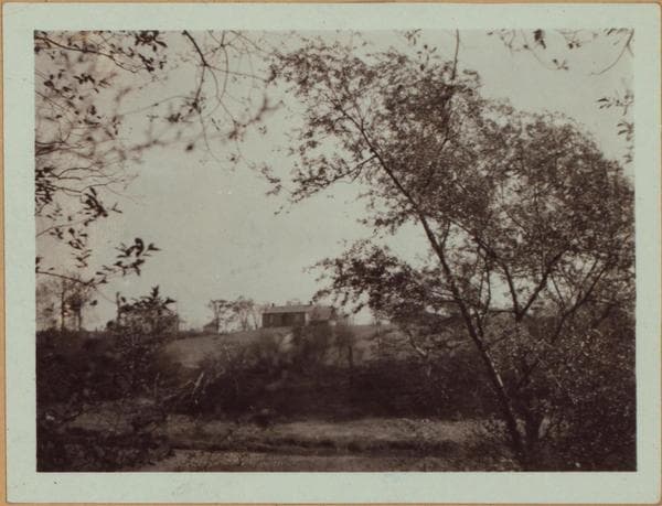
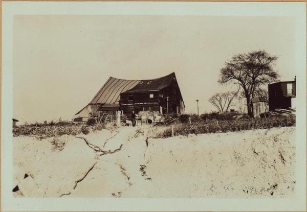
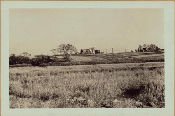
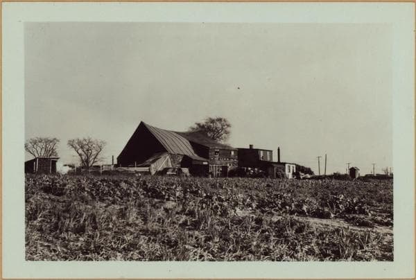
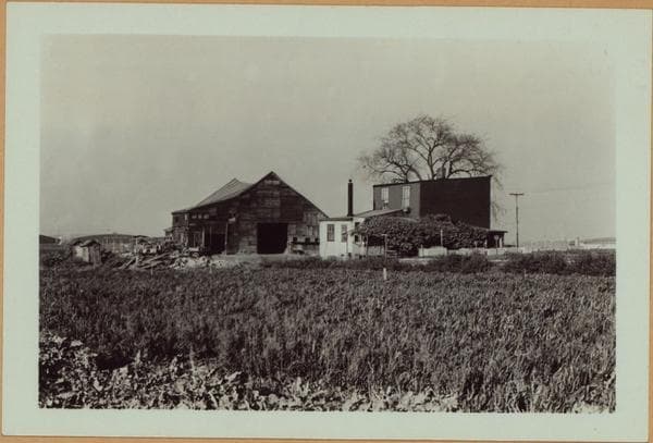
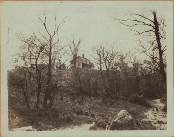
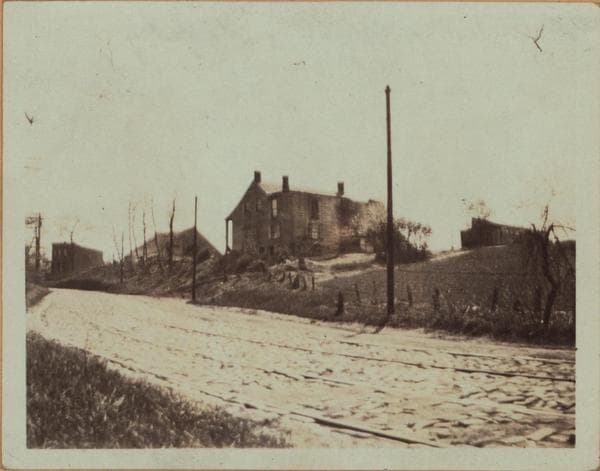
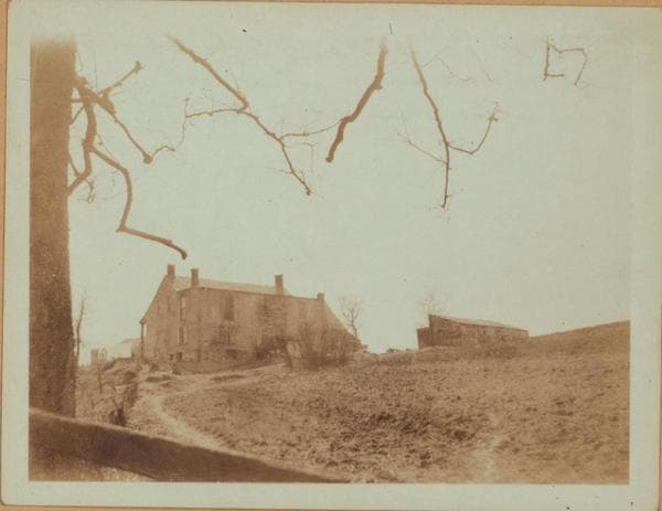
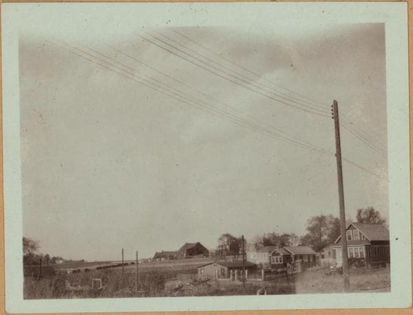
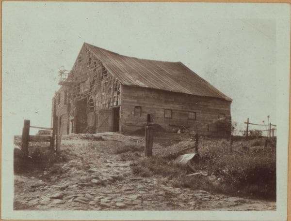
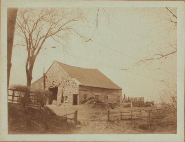
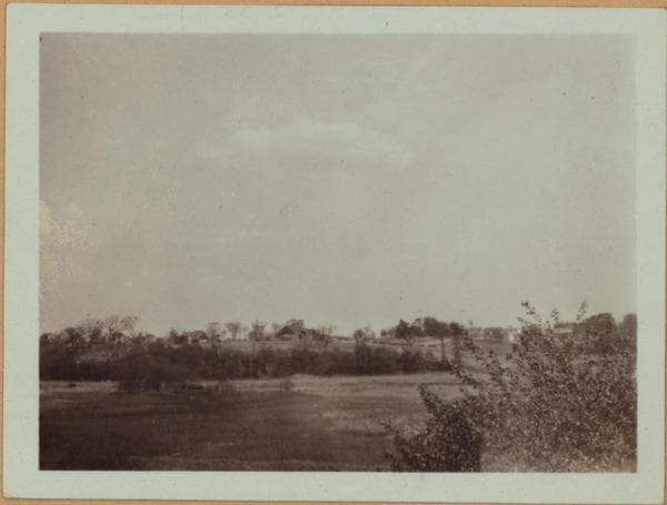
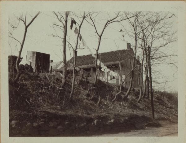
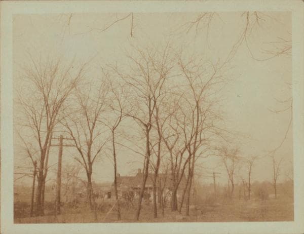
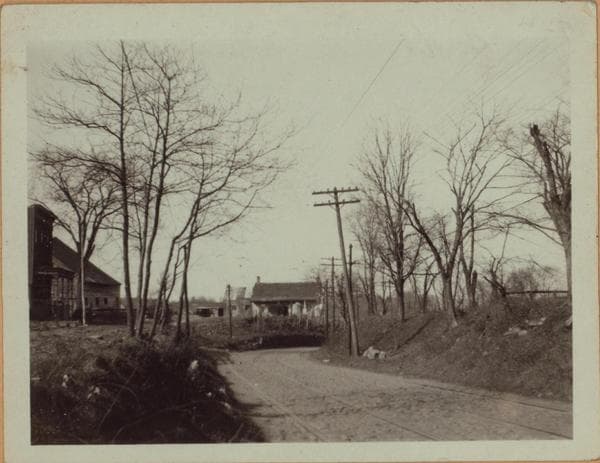
94th Street, west side, about 450 feet, north of Twenty-third Avenue, showing four views of the Abraham Rapelye farmhouse and outbuildings. This house was probably erected by Capt. Thomas Hagard shortly after 1724. This farm and the buildings were owned and occupied by members of the Rapelye family from 1787 to 1896. The history of this area is that Thomas Stevenson had a patent in 1651 on the Rev. Francis Doughty farm which lay between the Old Bowery Road and Flushing Bay and south of Mill Creek or as it is also known as Jackson Creek. In 1787 it became the property of Abraham Rapelye. He built a dock on Flushing Bay just south of the mouth of Jackson's Creek which in those days was probably at 96th Street, and south of this house between Old Bowery Bay Rd. and the Hazard tract which was also purchased by Daniel Rapelye. It was later known as Strongs farm; it being the property of Aletta Rapelye Strong. The successive owners that followed were Wm. W. Thomas, Dr. Oliver Jones of Cold Spring Harbor,and the Navahoe Realty Company. The Doughty house stood on the shore of Flushing Bay on a lane made by Dr. Adrian Van der Douck. It was the house of the Rapelye, Remsen and Strong families and was located at or near the present site of the Strong residence. The wing of the Rapelye house collapsed in November 1933 and the building was demolished in March 1934. March 1923 Views 1 and 2 Views 3&4: May 1929 Eugene L. Armbruster Collection

Photo from the New York Public Library - Milstein Collection

See this spot on the mapView on NYPL Digital Collections (opens in a new tab)

See this photo in high resolution

Zoom into the full-resolution scan in the OldNYC app for iPhone with OldNYC Supporter ($4.99). The free app also centers the map on you, so you can find the photos taken closest to where you stand.
Download on the App Store (opens the App Store)
QR code that opens OldNYC on the App Store

Or scan with your iPhone