VVestiges of New York49,000+ historical photos
MapBrowseAboutGet the iPhone app (opens the App Store)
  1. Browse /
  2. Queens /
  3. This place

Bayside Avenue & Strang Avenue, Queens

8 historical photos taken here in 1925, oldest first.

See this spot on the map

Photos

  • Queens: Bayside Avenue - Strang Avenue, 1925

    Queens: Bayside Avenue - Strang Avenue

    1925

  • Queens: Bayside Avenue - Strang Avenue, 1925

    Queens: Bayside Avenue - Strang Avenue

    1925

  • Queens: Bayside Avenue - Strang Avenue, 1925

    Queens: Bayside Avenue - Strang Avenue

    1925

  • Queens: Bayside Avenue - Strang Avenue, 1925

    Queens: Bayside Avenue - Strang Avenue

    1925

  • Queens: Bayside Avenue - Strang Avenue, 1925

    Queens: Bayside Avenue - Strang Avenue

    1925

  • Queens: Bayside Avenue - Strang Avenue, 1925

    Queens: Bayside Avenue - Strang Avenue

    1925

  • Queens: Bayside Avenue - Strang Avenue, 1925

    Queens: Bayside Avenue - Strang Avenue

    1925

  • Queens: Bayside Avenue - Strang Avenue, 1925

    Queens: Bayside Avenue - Strang Avenue

    1925

Stand where these photos were taken

The free OldNYC app for iPhone centers the map on you and shows the historical photos taken closest to where you are.
Download on the App Store (opens the App Store)
QR code that opens OldNYC on the App Store

Or scan with your iPhone

Explore

  • Map
  • Browse by place
  • Browse by decade

Boroughs

  • Manhattan
  • Brooklyn
  • Queens
  • Bronx
  • Staten Island

About

  • About and contact
  • Privacy

Photos: The New York Public Library, Milstein Collection

OldNYC for iPhone

Find the historical photos taken closest to where you stand.

Download on the App Store (opens the App Store)QR code that opens OldNYC on the App Store
Queens: Bayside Avenue - Strang Avenue, 1925

Photo 4 of 8 at Bayside Avenue & Strang Avenue, Queens

Queens: Bayside Avenue - Strang Avenue

1925

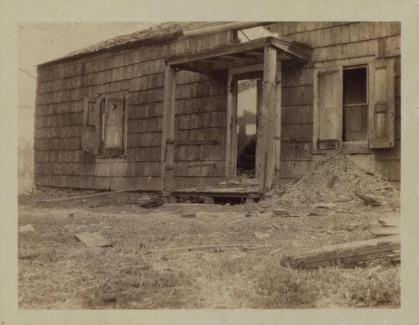
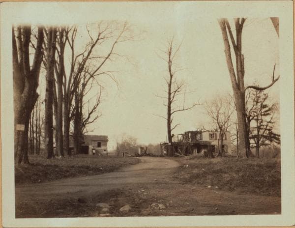
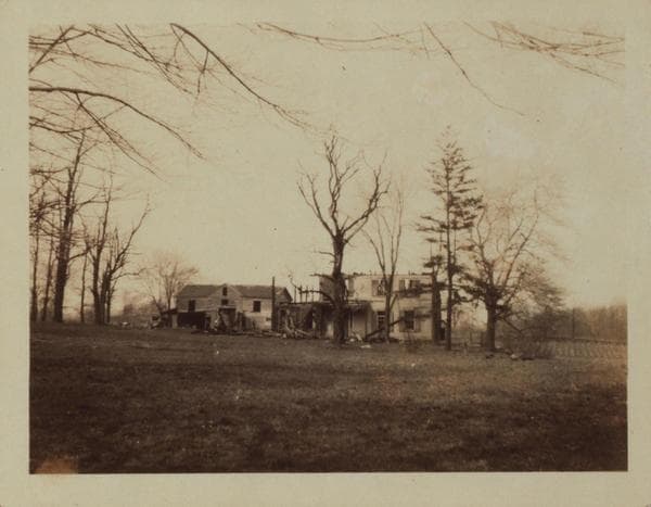
Bayside Ave. (also Twenty-ninth Ave. at this point), between (15th and 16th Streets) 155th and 156th Streets, showing in a set of four views the Walter Bowne house and its out-buildings. One, Bedell, states that a Revolutionary War burying place was northeast of the house, to which, 35 years ago, necessitated the crossing of the stone wall seen in the background of No. 4, at the large Buttonball tree, the stump of which remains today. At that time, flat stones used as markers were still standing; they having been obliterated when the orchard was removed by the wagons. Members of the Bowne family (3rd generation since the War) mentioned the Burial Ground and Spring and Water Bay to him. However, Eugene L. Armbruster states that it was on the line of old 17th (now 157th) Street. For more data, see, other views. Eugene L. Armbruster Collection. April 1925.

Photo from the New York Public Library - Milstein Collection

See this spot on the mapView on NYPL Digital Collections (opens in a new tab)

See this photo in high resolution

Zoom into the full-resolution scan in the OldNYC app for iPhone with OldNYC Supporter ($4.99). The free app also centers the map on you, so you can find the photos taken closest to where you stand.
Download on the App Store (opens the App Store)
QR code that opens OldNYC on the App Store

Or scan with your iPhone