VVestiges of New York49,000+ historical photos
MapBrowseAboutGet the iPhone app (opens the App Store)
  1. Browse /
  2. Queens /
  3. This place

Horatio Parkway & 53rd Avenue, Queens

3 historical photos taken here in 1924, oldest first.
See this spot on the map

Photos

  • Queens: Horatio Parkway - 53rd Avenue, 1924

    Queens: Horatio Parkway - 53rd Avenue

    1924

  • Queens: Horatio Parkway - 53rd Avenue, 1924

    Queens: Horatio Parkway - 53rd Avenue

    1924

  • Queens: Horatio Parkway - 53rd Avenue, 1924

    Queens: Horatio Parkway - 53rd Avenue

    1924

Stand where these photos were taken

The free OldNYC app for iPhone centers the map on you and shows the historical photos taken closest to where you are.
Download on the App Store (opens the App Store)
QR code that opens OldNYC on the App Store

Or scan with your iPhone

Explore

  • Map
  • Browse by place
  • Browse by decade

Boroughs

  • Manhattan
  • Brooklyn
  • Queens
  • Bronx
  • Staten Island

About

  • About and contact
  • Privacy

Photos: The New York Public Library, Milstein Collection

OldNYC for iPhone

Find the historical photos taken closest to where you stand.

Download on the App Store (opens the App Store)QR code that opens OldNYC on the App Store
Queens: Horatio Parkway - 53rd Avenue, 1924

Photo 1 of 3 at Horatio Parkway & 53rd Avenue, Queens

Queens: Horatio Parkway - 53rd Avenue

1924

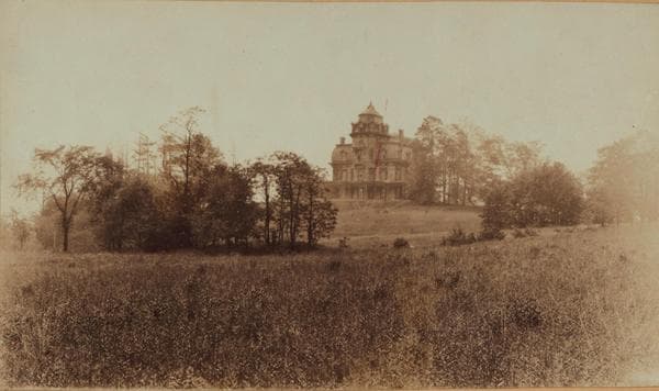
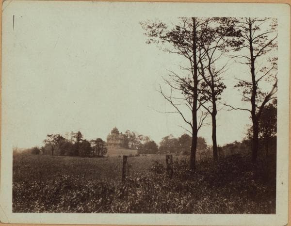
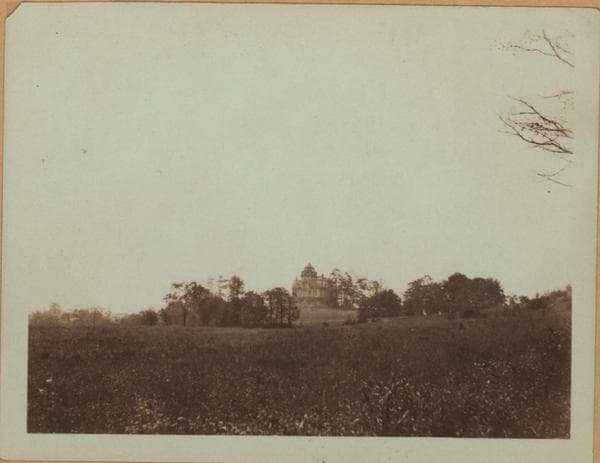
Horatio Parkway, west side, between 53rd Avenue and 230th Street, Bayside, showing the F.N. Lawrence Mansion, an imposing frame structure. According to Mr. Armbruster, the mansion, situated on a large estate, was owned by F.N. Lawrence in 1860 and by W.H. Sanger in 1873. Beers's 1873 map also shows it as the Sanger property, just below the Boyce farm on Oakland Lake (Douglas Pond). The estate, known as "The Oaks," was opened by a member of the Hicks family and afterwards owned by Lawrence and later by John Henderson and John Taylor. In 1891 it was owned by John Taylor (Wolverton's map) and then comprised 263.25 acres. It was the F.H. Taylor property in 1909. The distant views were most likely taken from Horace Harding Boulevard, formerly West Alley, which marked the southern limit of the estate. The Horatio Parkway location marks the site of the mansion proper, were it standing when the new thoroughfares were laid out. Eugene L. Armbruster Collection 1924 Views 1,2,3

Photo from the New York Public Library - Milstein Collection

See this spot on the mapView on NYPL Digital Collections (opens in a new tab)
See this photo in high resolution

Zoom into the full-resolution scan in the OldNYC app for iPhone with OldNYC Supporter ($4.99). The free app also centers the map on you, so you can find the photos taken closest to where you stand.
Download on the App Store (opens the App Store)
QR code that opens OldNYC on the App Store

Or scan with your iPhone