VVestiges of New York49,000+ historical photos
MapBrowseAboutGet the iPhone app (opens the App Store)
  1. Browse /
  2. Staten Island /
  3. This place

Maryland Avenue & Fox Hill Terrace, Staten Island

2 historical photos taken here in 1931, oldest first.
See this spot on the map

Photos

  • Richmond: Maryland Avenue - Fox Hill Terrace, 1931

    Richmond: Maryland Avenue - Fox Hill Terrace

    1931

  • Richmond: Maryland Avenue - Fox Hill Terrace, 1931

    Richmond: Maryland Avenue - Fox Hill Terrace

    1931

Stand where these photos were taken

The free OldNYC app for iPhone centers the map on you and shows the historical photos taken closest to where you are.
Download on the App Store (opens the App Store)
QR code that opens OldNYC on the App Store

Or scan with your iPhone

Nearby places

  • Tompkins Avenue & Clifton Avenue, Staten Island (2 photos)
  • Amity Street & White Plains Avenue, Staten Island (4 photos)
  • Tompkins Avenue & St. Marys Avenue, Staten Island (4 photos)
  • Bell Street & Smith Street, Staten Island (3 photos)
  • Bell Street & Reynolds Street, Staten Island (6 photos)

Explore

  • Map
  • Browse by place
  • Browse by decade

Boroughs

  • Manhattan
  • Brooklyn
  • Queens
  • Bronx
  • Staten Island

About

  • About and contact
  • Privacy

Photos: The New York Public Library, Milstein Collection

OldNYC for iPhone

Find the historical photos taken closest to where you stand.

Download on the App Store (opens the App Store)QR code that opens OldNYC on the App Store
Richmond: Maryland Avenue - Fox Hill Terrace, 1931

Photo 1 of 2 at Maryland Avenue & Fox Hill Terrace, Staten Island

Richmond: Maryland Avenue - Fox Hill Terrace

1931

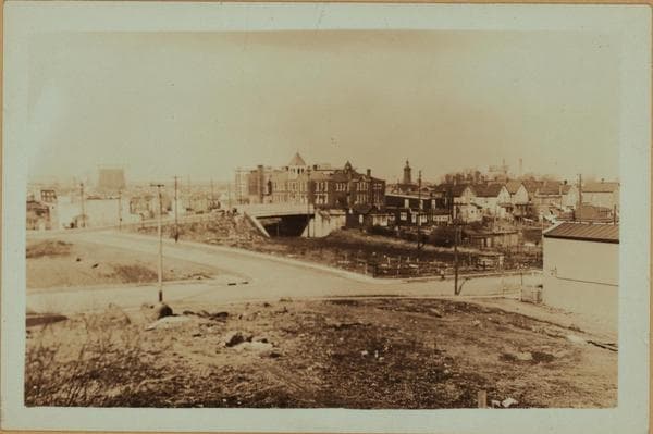
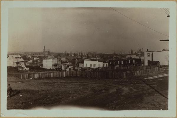
(1) Rosebank, Staten Island: A panoramic view across the village, toward the Upper Bay, seen from Maryland Avenue and Fox Hill Terrace. On the right can be seen the steeple of St. Marys R.C. Church, on Bay Street; in the center is a group of warehouses; on the left is the stack of the G. Siegle Color Works, on Chestnut Avenue. P. L. Sperr January 18, 1931 (2) Another view across Rosebank, in the same general direction as seen from Maryland and Vermont Avenues. In the center of the view is Public School No. 13, on Hyland Boulevard and Anderson Street; preceding the school is the Hylan Boulevard bridge over the Staten Island tracks; to the right of the church spire are two stacks of the Wrigley chewing gum plant, and running from left to right, in the foreground, is Maryland Avenue; running perpendicular to the latter and the Boulevard is Vermont Avenue. P. L. Sperr February 2, 1931

Photo from the New York Public Library - Milstein Collection

See this spot on the mapView on NYPL Digital Collections (opens in a new tab)
See this photo in high resolution

Zoom into the full-resolution scan in the OldNYC app for iPhone with OldNYC Supporter ($4.99). The free app also centers the map on you, so you can find the photos taken closest to where you stand.
Download on the App Store (opens the App Store)
QR code that opens OldNYC on the App Store

Or scan with your iPhone