VVestiges of New York49,000+ historical photos
MapBrowseAboutGet the iPhone app (opens the App Store)
  1. Browse /
  2. Staten Island /
  3. This place

Richmond Road & New Dorp Lane, Staten Island

4 historical photos taken here between 1900 and 1926, oldest first.

See this spot on the map

Photos

  • Richmond: Richmond Road - New Dorp Lane, 1900

    Richmond: Richmond Road - New Dorp Lane

    1900

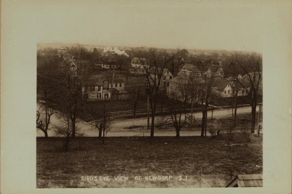
  • Richmond: Richmond Road - New Dorp Lane, 1905

    Richmond: Richmond Road - New Dorp Lane

    1905

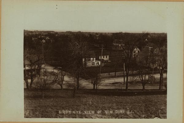
  • Richmond: Richmond Road - New Dorp Lane, 1905

    Richmond: Richmond Road - New Dorp Lane

    1905

  • Richmond: Richmond Road - New Dorp Lane, 1926

    Richmond: Richmond Road - New Dorp Lane

    1926

Stand where these photos were taken

The free OldNYC app for iPhone centers the map on you and shows the historical photos taken closest to where you are.
Download on the App Store (opens the App Store)
QR code that opens OldNYC on the App Store

Or scan with your iPhone

Nearby places

  • New Dorp Lane & 2nd Street, Staten Island (3 photos)
  • Richmond Road & Amboy Road, Staten Island (6 photos)
  • New Dorp Lane & 3rd Street, Staten Island (5 photos)
  • Richmond Road & Altamount Street, Staten Island (3 photos)
  • Richmond Road & Otis Avenue, Staten Island (8 photos)
  • New Dorp Lane & South Railroad Avenue, Staten Island (5 photos)
  • Richmond Road & Summit Avenue, Staten Island (2 photos)
  • New Dorp Lane & 8th Street, Staten Island (2 photos)

Explore

  • Map
  • Browse by place
  • Browse by decade

Boroughs

  • Manhattan
  • Brooklyn
  • Queens
  • Bronx
  • Staten Island

About

  • About and contact
  • Privacy

Photos: The New York Public Library, Milstein Collection

OldNYC for iPhone

Find the historical photos taken closest to where you stand.

Download on the App Store (opens the App Store)QR code that opens OldNYC on the App Store
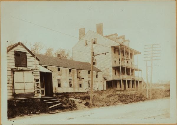
Richmond: Richmond Road - New Dorp Lane, 1900

Photo 1 of 4 at Richmond Road & New Dorp Lane, Staten Island

Richmond: Richmond Road - New Dorp Lane

1900

Richmond Road, north side, adjoining (to the east) New Dorp Lane, showing the Patten House. It was built in 1836 by Colonel John Patten as a hostelry to accommodate the crowds who came to see the New Dorp races. It was the headquarters of General Van Buren, commanding the State Militia of this military district. Commodore Vanderbilt was a frequent visitor here. It was also the headquarters of the Owls Club of which Wm. H. Vanderbilt, Senator "Sam" Frost and Judge Daniel Clawson were members. It closed as a public hostelry in 1887, after which it was used by Father McGlynn as a branch of a Roman Catholic institution. Later it was used as a tenement house by Italian ragpickers. It was condemned by the Board of Health as a hazard to health and safety and was finally razed in 1902. See the "New York Tribune", June 29, 1902, illustrated supplement, p. 5. About 1900 By Eugene G. Putnam From Staten Island Museum Collection through P. L. Sperr

Photo from the New York Public Library - Milstein Collection
See this spot on the mapView on NYPL Digital Collections (opens in a new tab)

See this photo in high resolution

Zoom into the full-resolution scan in the OldNYC app for iPhone with OldNYC Supporter ($4.99). The free app also centers the map on you, so you can find the photos taken closest to where you stand.
Download on the App Store (opens the App Store)
QR code that opens OldNYC on the App Store

Or scan with your iPhone