VVestiges of New York49,000+ historical photos
MapBrowseAboutGet the iPhone app (opens the App Store)
  1. Browse /
  2. Brooklyn /
  3. This place

Flushing Avenue & Cypress Avenue, Brooklyn

13 historical photos taken here between 1922 and 1929, oldest first.

See this spot on the map

Photos

  • Brooklyn: Flushing Avenue - Cypress Avenue, 1922–1928

    Brooklyn: Flushing Avenue - Cypress Avenue

    1922; 1928

  • Brooklyn: Flushing Avenue - Cypress Avenue, 1922–1928

    Brooklyn: Flushing Avenue - Cypress Avenue

    1922; 1928

  • Brooklyn: Flushing Avenue - Cypress Avenue, 1922–1928

    Brooklyn: Flushing Avenue - Cypress Avenue

    1922; 1928
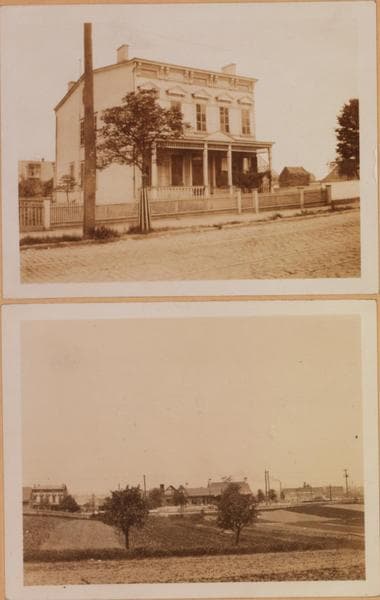
  • Brooklyn: Flushing Avenue - Scott Avenue, 1923–1928

    Brooklyn: Flushing Avenue - Scott Avenue

    1923; 1928

  • Brooklyn: Flushing Avenue - Scott Avenue, 1923–1928

    Brooklyn: Flushing Avenue - Scott Avenue

    1923; 1928
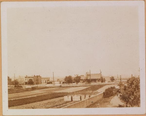
  • Brooklyn: Flushing Avenue - Scott Avenue, 1923–1928

    Brooklyn: Flushing Avenue - Scott Avenue

    1923; 1928
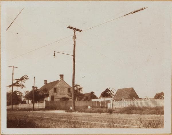
  • Brooklyn: Flushing Avenue - Cypress Avenue, 1928

    Brooklyn: Flushing Avenue - Cypress Avenue

    1928

  • Brooklyn: Johnson Avenue - Scott Avenue, 1928–1929

    Brooklyn: Johnson Avenue - Scott Avenue

    1928; 1929
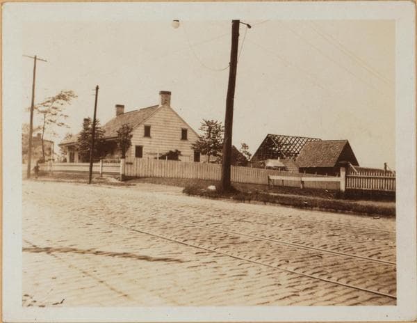
  • Brooklyn: Flushing Avenue - Cypress Avenue, 1928

    Brooklyn: Flushing Avenue - Cypress Avenue
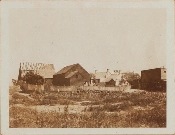
    1928

  • Brooklyn: Flushing Avenue - Cypress Avenue, 1928

    Brooklyn: Flushing Avenue - Cypress Avenue
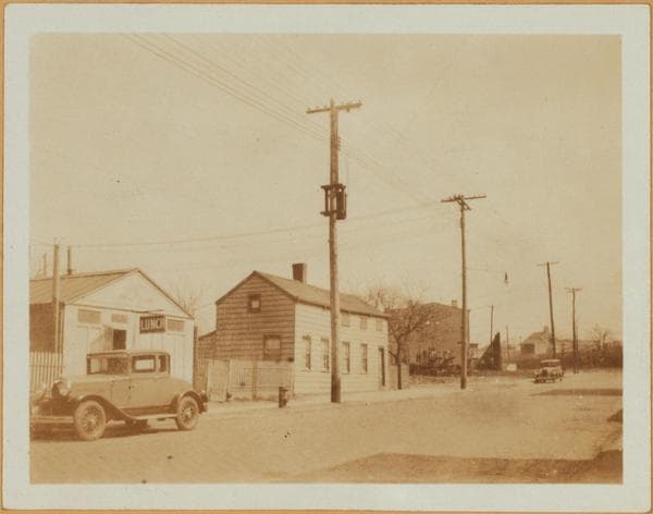
    1928

  • Brooklyn: Johnson Avenue - Scott Avenue, 1928–1929

    Brooklyn: Johnson Avenue - Scott Avenue

    1928; 1929
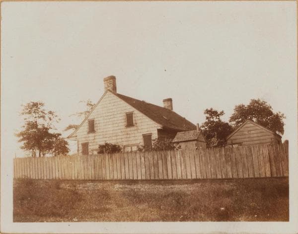
  • Brooklyn: Flushing Avenue - Cypress Avenue, 1928

    Brooklyn: Flushing Avenue - Cypress Avenue

    1928

  • Brooklyn: Flushing Avenue - Cypress Avenue, 1929

    Brooklyn: Flushing Avenue - Cypress Avenue

    1929

Stand where these photos were taken

The free OldNYC app for iPhone centers the map on you and shows the historical photos taken closest to where you are.
Download on the App Store (opens the App Store)
QR code that opens OldNYC on the App Store

Or scan with your iPhone

Nearby places

  • Flushing Avenue & Seneca Avenue, Brooklyn (6 photos)
  • Troutman Street & Seneca Avenue, Queens (3 photos)
  • Flushing Avenue & Seneca Avenue, Queens (13 photos)
  • Flushing Avenue & Onderdonk Avenue, Queens (8 photos)
  • Flushing Avenue & Woodward Avenue, Queens (23 photos)

Explore

  • Map
  • Browse by place
  • Browse by decade

Boroughs

  • Manhattan
  • Brooklyn
  • Queens
  • Bronx
  • Staten Island

About

  • About and contact
  • Privacy

Photos: The New York Public Library, Milstein Collection

OldNYC for iPhone

Find the historical photos taken closest to where you stand.

Download on the App Store (opens the App Store)QR code that opens OldNYC on the App Store
Brooklyn: Flushing Avenue - Cypress Avenue, 1928

Photo 9 of 13 at Flushing Avenue & Cypress Avenue, Brooklyn

Brooklyn: Flushing Avenue - Cypress Avenue

1928

1325 Flushing Ave., north side, between Cypress Ave., and Seneca Avenue, showing in a set of four views the Nicholas Wyckoff home, also known as the Peter Wyckoff home. Views 1 and 2 are the same. No. 3 is a rear view, looking southwest towards Flushing Ave. No. 4 is a partial view of No. 2. Peter Wyckoff occupied this house during the Revolutionary War. Prior to this, in 1765, it was the Schenck farmhouse. In that year Nicholas Wyckoff acquired possession. Eugene L. Armbruster states that a broad hall runs through the center of the house, on the left side of the hall is a parlor and sitting room. On the other side of the hall is a dining room, kitchen, and three bedrooms. In the sitting room is a colonial mantle piece, having pictures of the old Rapelye, Johnson, and Wyckoff houses. The upper floors contain eight rooms and a garret. In a corner of the hall is an ancient grandfather clock still keeping time. See other views for more data. For more data see the N.Y. Sun, February 18, 1939. September 1928. Views 1 & 4. Views 2 & 3: 1922. Eugene L. Armbruster Collection.

Photo from the New York Public Library - Milstein Collection

See this spot on the mapView on NYPL Digital Collections (opens in a new tab)

See this photo in high resolution

Zoom into the full-resolution scan in the OldNYC app for iPhone with OldNYC Supporter ($4.99). The free app also centers the map on you, so you can find the photos taken closest to where you stand.
Download on the App Store (opens the App Store)
QR code that opens OldNYC on the App Store

Or scan with your iPhone