VVestiges of New York49,000+ historical photos
MapBrowseAboutGet the iPhone app (opens the App Store)
  1. Browse /
  2. Manhattan /
  3. This place

St. Nicholas Avenue & Fort George Avenue, Manhattan

13 historical photos taken here between 1927 and 1940, oldest first.

See this spot on the map

Photos

  • Manhattan: Wadsworth Avenue - St. Nicholas Avenue, 1927

    Manhattan: Wadsworth Avenue - St. Nicholas Avenue
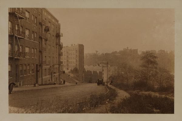
    1927

  • Manhattan: Fairview Avenue - St. Nicholas Avenue, 1927

    Manhattan: Fairview Avenue - St. Nicholas Avenue

    1927

  • Manhattan: St. Nicholas Avenue - Fort George Avenue, 1937

    Manhattan: St. Nicholas Avenue - Fort George Avenue

    1937

  • Manhattan: St. Nicholas Avenue - Fort George Avenue, 1937

    Manhattan: St. Nicholas Avenue - Fort George Avenue

    1937

  • Manhattan: St. Nicholas Avenue - Fairview Avenue, 1937

    Manhattan: St. Nicholas Avenue - Fairview Avenue

    1937

  • Manhattan: St. Nicholas Avenue - Fort George Avenue, 1937

    Manhattan: St. Nicholas Avenue - Fort George Avenue
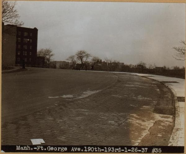
    1937

  • Manhattan: Fort George Avenue - 190th Street (West), 1937

    Manhattan: Fort George Avenue - 190th Street (West)

    1937

  • General view - [Manhattan - St. Nicholas Avenue - Fairview Avenue - Dyckman Street (West).], 1937

    General view - [Manhattan - St. Nicholas Avenue - Fairview Avenue - Dyckman Street (West).]
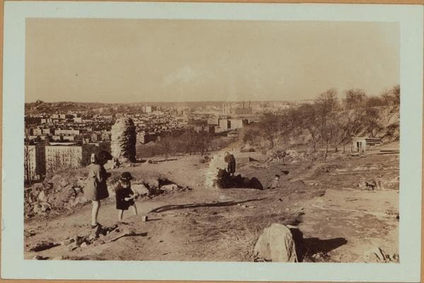
    1937

  • Manhattan: St. Nicholas Avenue - Fairview Avenue, 1937

    Manhattan: St. Nicholas Avenue - Fairview Avenue
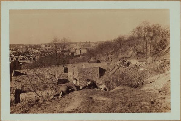
    1937

  • Manhattan: St. Nicholas Avenue - Fairview Avenue, 1937

    Manhattan: St. Nicholas Avenue - Fairview Avenue

    1937

  • Manhattan: St. Nicholas Avenue - Fort George Avenue, 1940

    Manhattan: St. Nicholas Avenue - Fort George Avenue

    1940

  • Manhattan: St. Nicholas Avenue - Fort George Avenue, 1940

    Manhattan: St. Nicholas Avenue - Fort George Avenue

    1940

  • Manhattan: St. Nicholas Avenue - Fort George Avenue, 1940

    Manhattan: St. Nicholas Avenue - Fort George Avenue

    1940

Stand where these photos were taken

The free OldNYC app for iPhone centers the map on you and shows the historical photos taken closest to where you are.
Download on the App Store (opens the App Store)
QR code that opens OldNYC on the App Store

Or scan with your iPhone

Nearby places

  • Audubon Avenue & 193rd Street, Manhattan (5 photos)
  • Broadway & Nagle Avenue, Manhattan (7 photos)
  • Wadsworth Avenue & 189th Street, Manhattan (2 photos)
  • Broadway & West 193rd Street, Manhattan (5 photos)
  • Broadway & 190th Street, Manhattan (7 photos)
  • Bennett Avenue & 192nd Street, Manhattan (3 photos)
  • Wadsworth Avenue & 187th Street, Manhattan (3 photos)
  • Harlem River Drive & Dyckman Street, Manhattan (8 photos)

Explore

  • Map
  • Browse by place
  • Browse by decade

Boroughs

  • Manhattan
  • Brooklyn
  • Queens
  • Bronx
  • Staten Island

About

  • About and contact
  • Privacy

Photos: The New York Public Library, Milstein Collection

OldNYC for iPhone

Find the historical photos taken closest to where you stand.

Download on the App Store (opens the App Store)QR code that opens OldNYC on the App Store
General view - [Manhattan - St. Nicholas Avenue - Fairview Avenue - Dyckman Street (West).], 1937

Photo 8 of 13 at St. Nicholas Avenue & Fort George Avenue, Manhattan

General view - [Manhattan - St. Nicholas Avenue - Fairview Avenue - Dyckman Street (West).]

1937

A general view westward of the area immediately north (right) and south of Dyckman Street, as seen from St. Nicholas Ave., at the N.W. corner of Fairview Ave. (vantage point). In the left background appears the northern tip of Fort Tryon Park and The Cloisters, a division of the Metropolitan Museum of Art, displaying primarily, art objects of the renaissance period of Gothic and Norman origin. At the right, across Dyckman Street, is the southern edge of Inwood Hill Park. Note also (centre background) a portion of the Hudson River and the Palisades cliffs of New Jersey. April 20, 1937. P. L. Sperr.

Photo from the New York Public Library - Milstein Collection

See this spot on the mapView on NYPL Digital Collections (opens in a new tab)

See this photo in high resolution

Zoom into the full-resolution scan in the OldNYC app for iPhone with OldNYC Supporter ($4.99). The free app also centers the map on you, so you can find the photos taken closest to where you stand.
Download on the App Store (opens the App Store)
QR code that opens OldNYC on the App Store

Or scan with your iPhone