VVestiges of New York49,000+ historical photos
MapBrowseAboutGet the iPhone app (opens the App Store)
  1. Browse /
  2. Staten Island /
  3. This place

Stapleton, Staten Island

9 historical photos taken here between 1931 and 1937, oldest first.

See this spot on the map

Photos

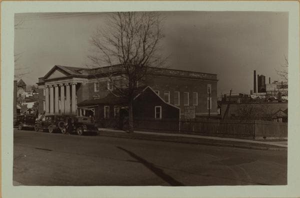
  • Richmond: Targee Street - Purdy Street, 1931

    Richmond: Targee Street - Purdy Street
    1931

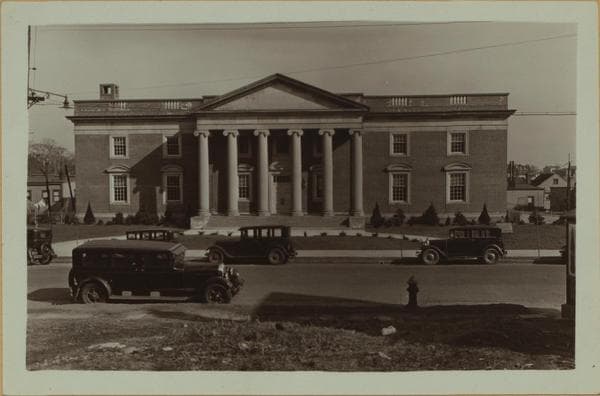
  • Richmond: Targee Street - Purdy Street, 1931

    Richmond: Targee Street - Purdy Street

    1931

  • Richmond: Targee Street - Frean Street, 1931

    Richmond: Targee Street - Frean Street

    1931

  • Richmond:] Staten Island - Stapleton., 1937

    Richmond:] Staten Island - Stapleton.

    1937

  • Richmond:] Staten Island - Stapleton., 1937

    Richmond:] Staten Island - Stapleton.

    1937

  • Richmond:] Staten Island - Stapleton., 1937

    Richmond:] Staten Island - Stapleton.

    1937

  • Richmond:] Staten Island - Stapleton., 1937

    Richmond:] Staten Island - Stapleton.

    1937

  • Richmond:] Staten Island - Stapleton., 1937

    Richmond:] Staten Island - Stapleton.

    1937

  • Richmond:] Staten Island - Stapleton., 1937

    Richmond:] Staten Island - Stapleton.

    1937

Stand where these photos were taken

The free OldNYC app for iPhone centers the map on you and shows the historical photos taken closest to where you are.
Download on the App Store (opens the App Store)
QR code that opens OldNYC on the App Store

Or scan with your iPhone

Nearby places

  • Stapleton, Staten Island (4 photos)
  • Canal Street & Broad Street, Staten Island (5 photos)
  • Targee Street & Broad Street, Staten Island (8 photos)
  • Tompkins Avenue & Tompkins Street, Staten Island (2 photos)
  • Beach Street & Van Duzer Street, Staten Island (3 photos)
  • Canal Street & Wright Street, Staten Island (4 photos)

Explore

  • Map
  • Browse by place
  • Browse by decade

Boroughs

  • Manhattan
  • Brooklyn
  • Queens
  • Bronx
  • Staten Island

About

  • About and contact
  • Privacy

Photos: The New York Public Library, Milstein Collection

OldNYC for iPhone

Find the historical photos taken closest to where you stand.

Download on the App Store (opens the App Store)QR code that opens OldNYC on the App Store
Richmond:] Staten Island - Stapleton., 1937

Photo 4 of 9 at Stapleton, Staten Island

Richmond:] Staten Island - Stapleton.

1937

Stapleton, Staten Island: Three panoramic views southeast-ward across Stapleton, toward the Upper New York Bay and Brooklyn, seen from Pearl Street on Grymes Hill. In the center foreground is the 2nd District Municipal and Magistrate's Court House, at 67-71 Targee Street; in the left foreground is an ice manufacturing plant on Gordon Street and to its right is the Rubsam and Horrmann Brewery, its main building (with clock tower) being on Canal Street; in the right foreground is the United States Marine Hospital and across its right wing the Wrigley chewing gum plant; on the extreme right, on the edge of the clearance, is the Mariners' Family Asylum, 119 Tompkins Avenue. The wooded area beyond that is Rosebank. The piers facing on Murray Hulbert Avenue, begin with No. 14 counting in arithmetic progression from the left. P. L. Sperr June 23, 1937 Views 1, 2, 3

Photo from the New York Public Library - Milstein Collection

See this spot on the mapView on NYPL Digital Collections (opens in a new tab)

See this photo in high resolution

Zoom into the full-resolution scan in the OldNYC app for iPhone with OldNYC Supporter ($4.99). The free app also centers the map on you, so you can find the photos taken closest to where you stand.
Download on the App Store (opens the App Store)
QR code that opens OldNYC on the App Store

Or scan with your iPhone